
Denver County, Colorado, United States trails
Click on a trail to view its statistics, map and profile.
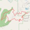
Turkey Trot Trail Loop
United States > Colorado > Jefferson County > Morrison
From the Mount Falcon Morrison Trailhead, the route sets out on Turkey Trot Trail above Vine Street, leaving the park edge for open foothill slopes, low scrub, and scattered pines with early views toward Morrison, Red Rocks Park, and the Denver plain. It continues west on Turkey Trot Trail as the loop wraps…
Distance: 3.3 mi • Elevation gain: 902 ft • Maximum elevation: 6,788 ft
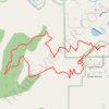
Turkey Trot Trail Loop via Castle Trail in Mount Falcon Park
United States > Colorado > Jefferson County > Morrison
From the Morrison Trailhead, the route starts on Castle Trail, leaving the edge of town for open foothill slopes, switchbacks and early views toward Red Rocks and the Denver skyline. It then joins Turkey Trot Trail, a hiker-focused section that climbs and contours through quieter pine, scrub and rocky hillside…
Distance: 3.4 mi • Elevation gain: 919 ft • Maximum elevation: 6,788 ft
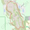
Trading Post Trail in Red Rocks Park
United States > Colorado > Jefferson County
The Trading Post Trail in Red Rocks Park is a delightful loop that showcases the park's breathtaking red rock formations and offers sweeping views of the surrounding landscapes. As you meander along this well-maintained path, you’ll encounter several sets of stairs that add a fun challenge, all while being…
Distance: 1.6 mi • Elevation gain: 361 ft • Maximum elevation: 6,276 ft
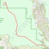
Mount Morrison Trail in Matthews/Winters Park
United States > Colorado > Jefferson County
The Mount Morrison Trail offers a rigorous climb through scenic terrain, providing hikers with expansive views of the surrounding Colorado landscape, including the iconic Red Rocks formations, the distant cityscape of Denver, and the rugged peaks of the Front Range. As you ascend, the trail showcases dramatic…
Distance: 3.6 mi • Elevation gain: 2,051 ft • Maximum elevation: 7,851 ft
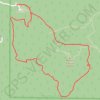
Mount Falcon Loop via Parmalee Trail, Meadow Trail and Castle Trail
United States > Colorado > Jefferson County
The Mount Falcon Loop via Parmalee, Meadow, and Castle Trails offers a diverse hiking experience through woodland, grassland, and rocky landscapes. As you make your way along the route, you’ll encounter expansive views of the Denver skyline, the Front Range peaks, and the distant Mount Evans Wilderness.…
Distance: 3.3 mi • Elevation gain: 620 ft • Maximum elevation: 7,743 ft