
Kane County, Utah, United States trails
Click on a trail to view its statistics, map and profile.
The Wave
United States > Utah > Kane County
From Wire Pass Trailhead, the route leaves House Rock Valley Road and follows the open desert toward Wire Pass, crossing sandy washes and sparse high-desert flats before entering the remote backcountry of Coyote Buttes North, a permit-only section of the Paria Canyon–Vermilion Cliffs Wilderness known for its…
Distance: 2.8 mi • Elevation gain: 699 ft • Maximum elevation: 5,233 ft
The Wave Trail in Vermilion Cliffs National Monument
United States > Utah > Kane County
The Wave Trail in Vermilion Cliffs National Monument offers hikers a journey through a landscape of undulating sandstone formations, vibrant red and orange hues, and expansive vistas of the surrounding desert terrain. The path meanders across varied terrains, including sandy stretches and smooth rock surfaces,…
Distance: 5.6 mi • Elevation gain: 945 ft • Maximum elevation: 5,210 ft
Buckskin Gulch
United States > Utah > Kane County
From Wire Pass Trailhead, the hike follows the sandy course of Coyote Wash along the Wire Pass Trail, crossing open desert before the wash tightens into Wire Pass Slot Canyon. Smooth sandstone walls, shaded narrows, and a nearby petroglyph panel lead toward the junction with Buckskin Gulch. At this junction,…
Distance: 10.3 mi • Elevation gain: 1,250 ft • Maximum elevation: 4,875 ft
Observation Point via East Mesa Trail in Zion National Park
United States > Utah > Kane County
The East Mesa Trail to Observation Point in Zion National Park offers a breathtaking hike through diverse landscapes, taking you through scrubby desert terrain and high-altitude plateaus, culminating in a breathtaking panorama of Zion Canyon. From the vantage point at Observation Point, one can marvel at…
Distance: 7.0 mi • Elevation gain: 784 ft • Maximum elevation: 6,804 ft
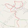
Dry Fork Narrows, Peek-A-Boo and Spooky Slot Canyons Loop
United States > Utah > Kane County
From the Dry Fork trailhead near Hole-in-the-Rock Road, the route crosses open slickrock and sandy desert benches before dropping into Dry Fork of Coyote Gulch, where the broad wash leads toward the smooth, shadowed corridors of Dry Fork Narrows. This Scorpion Wilderness Study Area hike sits within Grand…
Distance: 6.1 mi • Elevation gain: 728 ft • Maximum elevation: 4,977 ft
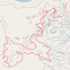
Upper Captain Ahab Loop Trail
United States > Utah > Grand County
The Upper Captain Ahab Loop Trail offers an exhilarating hike, featuring stunning desert landscapes and rugged terrain. As you traverse the winding path, you'll be treated to sweeping views of the Moab valley, the La Sal Mountains in the distance, and the Colorado River below. The trail is a technical…
Distance: 8.6 mi • Elevation gain: 1,762 ft • Maximum elevation: 4,902 ft
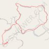
Spooky Slot Canyon and Peek-A-Boo Slot Canyon Loop Trail
United States > Utah > Kane County
The Peek-A-Boo and Spooky Slot Canyons Loop Trail offers a fascinating, though physically challenging, hiking experience in the Grand Staircase-Escalante National Monument. Hikers are treated to dramatic, narrow passages through the slot canyons, with Peek-A-Boo presenting impressive rock formations and a…
Distance: 2.9 mi • Elevation gain: 512 ft • Maximum elevation: 4,961 ft
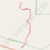
Toadstool Hoodoos Trail and Rimrocks Trail
United States > Utah > Kane County
The Toadstool Hoodoos and Rimrocks Trails in the Grand Staircase-Escalante National Monument offers a short but stunning hike through a landscape of colorful, mushroom-like rock formations. As you follow the easy path, you'll traverse expansive badlands and cross small washes, with the towering toadstools…
Distance: 1.7 mi • Elevation gain: 233 ft • Maximum elevation: 4,633 ft
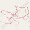
Peek-a-Boo Slot Canyon, Spooky Slot Canyon and Dry Fork Narrows Loop
United States > Utah > Kane County
Loop hike via Lower Dry Fork Trail, Peek-a-Boo Slot Canyon, Spooky Slot Canyon, Dry Fork Coyote Gulch Trail and Dry Fork Narrows Trail in the Scorpion Wilderness Study Area and the Grand Staircase-Escalante National Monument. #Hiking #Loop #Canyon #Nature #Wilderness
Distance: 3.7 mi • Elevation gain: 548 ft • Maximum elevation: 4,961 ft
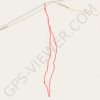
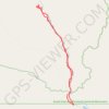
Wahweap Hoodoos Trail
United States > Utah > Kane County
Hike along the Wahweap Creek via the Nipple Canyon Road and the Wahweap Hoodoos Trail in the Grand Staircase-Escalante National Monument and the Wahweap Wilderness Study Area. #Hiking #Nature #River #Wilderness
Distance: 9.4 mi • Elevation gain: 515 ft • Maximum elevation: 4,308 ft
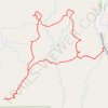
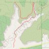
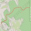
Panorama Loop Trail in Kodachrome Basin State Park
United States > Utah > Kane County
Distance: 4.4 mi • Elevation gain: 495 ft • Maximum elevation: 5,932 ft
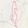
Tilted Mesa Morning Glory Middle Earth loop
United States > Utah > Kane County
Distance: 3.0 mi • Elevation gain: 423 ft • Maximum elevation: 5,384 ft
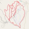
Tilted Mesa
United States > Utah > Kane County
Distance: 7.5 mi • Elevation gain: 860 ft • Maximum elevation: 5,387 ft
Angels Palace Trail
United States > Utah > Kane County
Distance: 1.5 mi • Elevation gain: 262 ft • Maximum elevation: 5,951 ft