The Narrows
Hike along Virgin River to The Narrows from Temple of Sinawava via Riverside Walk, The Narrows Day Hike Section, Mystery Canyon Falls, 200' Waterfall, House Rock and Floating Rock in the Zion National Park. #Hile #Canyon #River #Rock #Nature #Park #Falls #Zion
- Distance: 7.0 mi
- Elevation gain: 5,180 ft
- Maximum elevation: 5,194 ft
- Elevation loss: 5,174 ft
- Minimum elevation: 4,429 ft
Interactive trail map
Trail profile
- Distance: 7.0 mi
- Elevation gain: 5,180 ft
- Maximum elevation: 5,194 ft
- Elevation loss: 5,174 ft
- Minimum elevation: 4,429 ft
About this trail
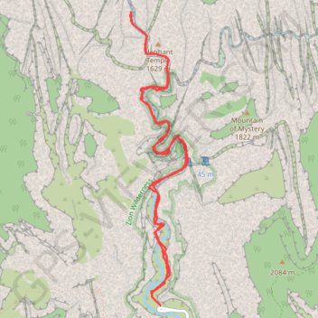
Name: The Narrows trail, distance, elevation, map, profile, GPS track
Start: Zion Canyon Scenic Drive, Washington County, Utah, United States (37.28527 -112.94775)
End: Zion Canyon Scenic Drive, Washington County, Utah, United States (37.28528 -112.94771)
Coordinates: 37.28527 -112.95142 37.31388 -112.94439
Topography: Washington County topographic map, elevation, terrain
Other hiking, mountain biking, running and outdoor activity trails
Click on a trail to view its statistics, map and profile.
The Narrows (Zion National Park)
United States > Utah > Washington County
From the Temple of Sinawava, the route enters the upper end of Zion Canyon and follows the Riverside Walk beside the Virgin River, where cottonwoods, hanging gardens, weeping sandstone walls and narrowing cliffs gradually frame the canyon corridor. At the end of the paved path, the hike continues directly in…
Distance: 2.8 mi • Elevation gain: 1,804 ft • Maximum elevation: 5,010 ft
Riverside Walk in Zion National Park
United States > Utah > Washington County
The Riverside Walk is a serene and accessible trail that allows visitors to explore the stunning landscapes of Zion Canyon. As you stroll alongside the Virgin River, you'll be captivated by towering cliffs, lush vegetation, and the soothing sounds of the flowing water. This short, paved path also offers…
Distance: 2.0 mi • Elevation gain: 1,165 ft • Maximum elevation: 4,826 ft