Make a donation
Gear up for your next adventure:
As an Amazon Associate, this site earns from qualifying purchases at no extra cost to you.
Big Springs via Zion Canyon and Mystery Canyon Waterfall
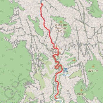
Interactive trail map
Make a donation
Gear up for your next adventure:
As an Amazon Associate, this site earns from qualifying purchases at no extra cost to you.
Trail profile
- Distance: 9.2 mi
- Elevation gain: 4,744 ft
- Maximum elevation: 5,167 ft
- Elevation loss: 4,744 ft
- Minimum elevation: 4,429 ft
Make a donation
Gear up for your next adventure:
As an Amazon Associate, this site earns from qualifying purchases at no extra cost to you.
About this trail
Name: Big Springs via Zion Canyon and Mystery Canyon Waterfall trail, distance, elevation, map, profile, GPS track
Start: Zion Canyon Scenic Drive, Washington County, Utah, United States (37.28518 -112.94766)
End: Zion Canyon Scenic Drive, Washington County, Utah, United States (37.28518 -112.94766)
Coordinates: 37.28518 -112.95745 37.33125 -112.94440
Topography: Washington County topographic map, elevation, terrain
Make a donation
Gear up for your next adventure:
As an Amazon Associate, this site earns from qualifying purchases at no extra cost to you.
Other hiking, mountain biking, running and outdoor activity trails
Click on a trail to view its statistics, map and profile.
Riverside Walk in Zion National Park
United States > Utah > Washington County
The Riverside Walk is a serene and accessible trail that allows visitors to explore the stunning landscapes of Zion Canyon. As you stroll alongside the Virgin River, you'll be captivated by towering cliffs, lush vegetation, and the soothing sounds of the flowing water. This short, paved path also offers…
Distance: 2.0 mi • Elevation gain: 1,165 ft • Maximum elevation: 4,826 ft
The Narrows
United States > Utah > Washington County
Hike along Virgin River to The Narrows from Temple of Sinawava via Riverside Walk, The Narrows Day Hike Section, Mystery Canyon Falls, 200' Waterfall, House Rock and Floating Rock in the Zion National Park. #Hile #Canyon #River #Rock #Nature #Park #Falls #Zion
Distance: 7.0 mi • Elevation gain: 5,180 ft • Maximum elevation: 5,194 ft
Make a donation
Gear up for your next adventure:
As an Amazon Associate, this site earns from qualifying purchases at no extra cost to you.