Lake Mary Dam via Catherine's Pass Trail
The Lake Mary Dam hike via Catherine’s Pass Trail offers a scenic and rewarding journey through the Uinta-Wasatch-Cache National Forest. Along the way, you'll encounter picturesque alpine lakes such as Lake Mary, Lake Martha, and Lake Catherine, with stunning views of rugged peaks like Mount Millicent. The trail also presents an opportunity for wildlife sightings, including moose and red-tailed hawks, while providing beautiful vistas of Big Cottonwood Canyon and Guardsman’s Pass. #Hiking #Mountain #Forest #Nature #Lake
- Distance: 6.2 mi
- Elevation gain: 1,765 ft
- Maximum elevation: 10,223 ft
- Elevation loss: 1,765 ft
- Minimum elevation: 9,386 ft
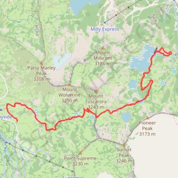
Interactive trail map
Trail profile
- Distance: 6.2 mi
- Elevation gain: 1,765 ft
- Maximum elevation: 10,223 ft
- Elevation loss: 1,765 ft
- Minimum elevation: 9,386 ft
About this trail
Name: Lake Mary Dam via Catherine's Pass Trail trail, distance, elevation, map, profile, GPS track
Start: 9399, Albion Basin Road, Alta, Salt Lake County, Utah, 84092, United States (40.58020 -111.61317)
End: 9399, Albion Basin Road, Alta, Salt Lake County, Utah, 84092, United States (40.58020 -111.61317)
Coordinates: 40.57902 -111.61507 40.59044 -111.58496
Topography: Salt Lake County topographic map, elevation, terrain
Other hiking, mountain biking, running and outdoor activity trails
Click on a trail to view its statistics, map and profile.
Cecret Lake Trail via Upper Albion Meadows Trail in Uinta-Wasatch-Cache National Forest
United States > Utah > Salt Lake County > Alta
The hike to Cecret Lake via the Upper Albion Meadows Trail offers a peaceful journey through colorful wildflower meadows, leading to a serene alpine lake surrounded by striking rocky cliffs. As you ascend, you’ll be treated to views of Albion Basin, where vibrant summer wildflowers and the chance to spot…
Distance: 4.6 mi • Elevation gain: 1,194 ft • Maximum elevation: 9,875 ft
Lake Catherine via Brighton Lakes Trail and Catherine's Pass Trail
United States > Utah > Salt Lake County > Brighton
This hike to Lake Catherine offers an immersive experience in the alpine beauty of the Uinta-Wasatch-Cache National Forest. The route leads you past three picturesque lakes—Lake Mary, Lake Martha, and Lake Catherine—while providing panoramic views of the surrounding peaks, like Mt. Wolverine, and lush…
Distance: 2.2 mi • Elevation gain: 1,224 ft • Maximum elevation: 10,000 ft
Lake Mary via Brighton Lakes Trail in Uinta-Wasatch-Cache National Forest
United States > Utah > Salt Lake County > Brighton
The Lake Mary Trail in Utah's Uinta-Wasatch-Cache National Forest offers a moderately challenging hike through dense forests of aspens and pines, leading to the serene alpine Lake Mary nestled beneath rugged cliffs. Along the way, hikers can enjoy panoramic views of surrounding peaks, including the impressive…
Distance: 2.3 mi • Elevation gain: 758 ft • Maximum elevation: 9,544 ft
Catherine's Pass Trail via Upper Albion Meadows Trail and East Greeley Road
United States > Utah > Salt Lake County > Alta
The Catherine's Pass Trail is a scenic hike located in the Uinta-Wasatch-Cache National Forest near Alta, Utah. The route offers a captivating mix of alpine meadows, striking wildflower displays in spring, and expansive views of surrounding peaks like Mount Wolverine and Sunset Peak. Along the way, you can…
Distance: 5.6 mi • Elevation gain: 1,578 ft • Maximum elevation: 10,223 ft
Lake Catherine Loop via Brighton Lakes Trail in Uinta-Wasatch-Cache National Forest
United States > Utah > Salt Lake County > Brighton
The Lake Catherine Loop via Brighton Lakes Trail offers hikers a journey through alpine forests, passing serene bodies of water like Lake Mary, Lake Martha, and Lake Catherine. Along the trail, one can admire the rugged silhouette of Mount Millicent and, during the summer months, vibrant wildflowers that dot…
Distance: 4.7 mi • Elevation gain: 1,342 ft • Maximum elevation: 10,033 ft