Glen Rock State Forest - Table Top
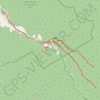
Interactive trail map
Trail profile
- Distance: 15.2 mi
- Elevation gain: 2,228 ft
- Maximum elevation: 2,612 ft
- Elevation loss: 2,224 ft
- Minimum elevation: 1,109 ft
About this trail
Name: Glen Rock State Forest - Table Top trail, distance, elevation, map, profile, GPS track
Coordinates: -27.92772 152.24679 -27.88730 152.30219
Other hiking, mountain biking, running and outdoor activity trails
Click on a trail to view its statistics, map and profile.
Warwick - Gatton
Australia > Queensland > Warwick
#Bike
Distance: 77.8 mi • Elevation gain: 2,664 ft • Maximum elevation: 1,909 ft
Walk to Glen Rock, QLD
Distance: 3.1 mi • Elevation gain: 1,519 ft • Maximum elevation: 2,582 ft
Black Duck
Distance: 28.4 mi • Elevation gain: 2,057 ft • Maximum elevation: 1,867 ft