Make a donation
Gear up for your next adventure:
As an Amazon Associate, this site earns from qualifying purchases at no extra cost to you.
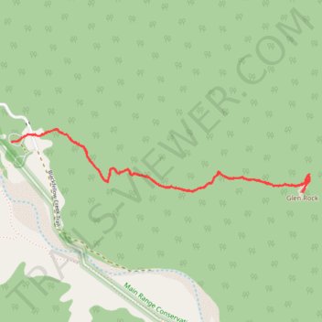
Walk to Glen Rock, QLD
- Distance: 3.1 mi
- Elevation gain: 1,519 ft
- Maximum elevation: 2,582 ft
- Elevation loss: 1,516 ft
- Minimum elevation: 1,112 ft
- Moving time: 2 h 17 m
- Moving speed: 1.4 mph
- Maximum speed: 2.9 mph
- Total time: 4 h 50 m
- Global speed: 0.6 mph
Interactive trail map
Make a donation
Gear up for your next adventure:
As an Amazon Associate, this site earns from qualifying purchases at no extra cost to you.
Trail profile
- Distance: 3.1 mi
- Elevation gain: 1,519 ft
- Maximum elevation: 2,582 ft
- Elevation loss: 1,516 ft
- Minimum elevation: 1,112 ft
- Moving time: 2 h 17 m
- Moving speed: 1.4 mph
- Maximum speed: 2.9 mph
- Total time: 4 h 50 m
- Global speed: 0.6 mph
Make a donation
Gear up for your next adventure:
As an Amazon Associate, this site earns from qualifying purchases at no extra cost to you.
About this trail
Name: Walk to Glen Rock, QLD trail, distance, elevation, map, profile, GPS track
Coordinates: -27.89052 152.24686 -27.88699 152.26563
Make a donation
Gear up for your next adventure:
As an Amazon Associate, this site earns from qualifying purchases at no extra cost to you.
Other hiking, mountain biking, running and outdoor activity trails
Click on a trail to view its statistics, map and profile.
Make a donation
Gear up for your next adventure:
As an Amazon Associate, this site earns from qualifying purchases at no extra cost to you.
Warwick - Gatton
Australia > Queensland > Warwick
#Bike
Distance: 77.8 mi • Elevation gain: 2,664 ft • Maximum elevation: 1,909 ft
Black Duck
Distance: 28.4 mi • Elevation gain: 2,057 ft • Maximum elevation: 1,867 ft