
Half Dome trails
Click on a trail to view its statistics, map and profile.
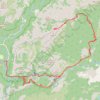
Half Dome
United States > California > Mariposa County > Curry Village
From Happy Isles, this demanding Yosemite route follows the Merced River into the forested canyon of the Mist Trail, passing the spray and granite stairways of Vernal Fall before continuing above the river toward Emerald Pool and the broader waterfall amphitheater around Nevada Fall. Beyond Nevada Fall, the…
Distance: 15.4 mi • Elevation gain: 6,506 ft • Maximum elevation: 8,816 ft
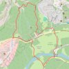
Lower Yosemite Fall and Cook's Meadow Trails Loop
United States > California > Mariposa County > Yosemite Village > Yosemite Lodge
Starting near Yosemite Valley Lodge, the route enters the Lower Yosemite Fall Trail, follows Yosemite Creek through shaded valley woodland, and reaches the footbridge and close viewpoint beneath Lower Yosemite Fall. It then returns toward Northside Drive and crosses into Cook’s Meadow, where open meadow…
Distance: 2.0 mi • Elevation gain: 246 ft • Maximum elevation: 4,108 ft
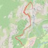
Upper Yosemite Fall Trail via Columbia Rock and Oh My Gosh Point
United States > California > Mariposa County > Yosemite Lodge
The Upper Yosemite Fall Trail is a rewarding yet challenging hike that offers some of the best panoramic views in Yosemite National Park. Climbing steep switchbacks, you'll pass Columbia Rock for breathtaking sights of Yosemite Valley and continue toward Oh My Gosh Point, where the dramatic view of the falls…
Distance: 7.4 mi • Elevation gain: 4,902 ft • Maximum elevation: 6,693 ft
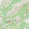
Half Dome via Vernal and Nevada Falls
United States > California > Mariposa County > Curry Village
Starting near Happy Isles in eastern Yosemite Valley, this route follows the Merced River into the Mist Trail corridor, with early granite scenery and possible views toward Illilouette Fall before reaching the Vernal Fall Footbridge. The ascent then climbs beside Vernal Fall to Emerald Pool and Silver Apron,…
Distance: 16.6 mi • Elevation gain: 6,739 ft • Maximum elevation: 8,835 ft
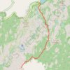
Clouds Rest from Tenaya Lake
United States > California > Mariposa County
From the Sunrise Lakes Trailhead beside Tenaya Lake, the route leaves Tioga Road and moves quickly from the open lakeshore into lodgepole forest and granite slabs, following the southbound trail signed for Clouds Rest and Sunrise before climbing away from the basin above Tenaya Creek. Beyond the Sunrise Lakes…
Distance: 12.0 mi • Elevation gain: 2,890 ft • Maximum elevation: 9,813 ft
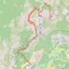
Upper Yosemite Fall, Yosemite Point, Oh My Gosh Point and Columbia Rock
United States > California > Mariposa County > Yosemite Village > Yosemite Lodge
Starting near Yosemite Lodge and the Camp Four area, this demanding route climbs the Upper Yosemite Fall Trail through oak woodland and granite switchbacks, quickly rising above Yosemite Valley toward Columbia Rock, where broad views open over the valley floor, Merced River corridor, Half Dome, and surrounding…
Distance: 9.3 mi • Elevation gain: 7,995 ft • Maximum elevation: 7,031 ft
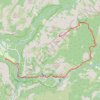
Half Dome via John Muir Trail and Vernal Fall in Yosemite National Park
United States > California > Mariposa County > Curry Village
The Half Dome hike is a true Yosemite adventure. With breathtaking views of the falls, Yosemite Valley, and the Sierra Nevada, it rewards those who tackle its challenging terrain. The final ascent up the cable route is thrilling, and while demanding, it’s an unforgettable experience that’s well worth the…
Distance: 16.3 mi • Elevation gain: 6,368 ft • Maximum elevation: 8,816 ft
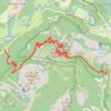
Four Mile Trail in Yosemite National Park
United States > California > Mariposa County > Yosemite Village > Yosemite Lodge
The Four Mile Trail in Yosemite National Park provides hikers with a challenging yet rewarding experience. As you ascend the trail, you'll be treated to ever-changing views of Yosemite Valley, including dramatic overlooks of Yosemite Falls, El Capitan, and Bridalveil Fall, with distant glimpses of the Sierra…
Distance: 10.3 mi • Elevation gain: 5,262 ft • Maximum elevation: 7,208 ft
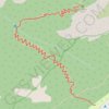
Columbia Rock
United States > California > Mariposa County > Yosemite Village > Yosemite Lodge
From the Yosemite Valley near Camp Four, the Upper Yosemite Fall Trail climbs steadily into the forest, following a long series of switchbacks above the valley floor. The route reaches Columbia Rock, a rocky overlook with a broad panorama over Yosemite Valley, Half Dome, Sentinel Rock and the surrounding…
Distance: 1.0 mi • Elevation gain: 1,171 ft • Maximum elevation: 5,023 ft
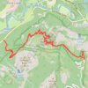
Glacier Point and Union Point via Four Mile Trail
United States > California > Mariposa County > Yosemite Village > Yosemite Lodge
From Yosemite Valley, the Four Mile Trail climbs away from the Merced River through forested slopes and long switchbacks on the south wall of the valley, steadily opening views toward Sentinel Rock, El Capitan, Yosemite Falls, and the granite cliffs that frame the valley floor. Higher on the route, the path…
Distance: 9.4 mi • Elevation gain: 5,404 ft • Maximum elevation: 7,208 ft
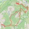
Sentinel Dome, Glacier Point, Union Point and Taft Point Loop (Yosemite)
United States > California > Mariposa County
From Sentinel Dome Trailhead, the loop begins among conifer forest, meadow and open granite before climbing toward Sentinel Dome, where the landscape opens to broad views over Yosemite Valley, Half Dome and the high Sierra. The route then swings toward Glacier Point, one of Yosemite’s classic overlooks above…
Distance: 13.3 mi • Elevation gain: 5,827 ft • Maximum elevation: 8,130 ft
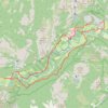
Yosemite Valley Loop
United States > California > Mariposa County > Yosemite Village
From Yosemite Village, the route slips into the Valley Loop Trail corridor, moving through the quieter village edge toward Yosemite Falls views before continuing west below the Three Brothers and into the open floor of Leidig Meadow, where forest, meadow grass, and the Merced River alternate along the way. The…
Distance: 9.2 mi • Elevation gain: 699 ft • Maximum elevation: 4,068 ft
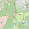
Lower Yosemite Fall Trail and Cook's Meadow Trail Loop in Yosemite National Park
United States > California > Mariposa County > Yosemite Village > Yosemite Lodge
The combined Lower Yosemite Fall and Cook's Meadow Trails Loop in Yosemite National Park offer hikers breathtaking views of iconic landmarks. Along this easy, flat path, you'll encounter stunning vistas of Yosemite Falls, Half Dome, Sentinel Rock, and Glacier Point, all set against the serene backdrop of lush…
Distance: 2.0 mi • Elevation gain: 240 ft • Maximum elevation: 4,104 ft
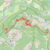
Glacier Point
United States > California > Mariposa County > Curry Village
Starting at Four Mile Trailhead in Yosemite Valley, the route joins the Four Mile Trail and begins its steady climb from the valley floor above the Merced River corridor. It first rises through forested slopes near Sentinel Creek, with early views opening toward Sentinel Rock and the meadows of Yosemite…
Distance: 4.8 mi • Elevation gain: 4,101 ft • Maximum elevation: 7,208 ft
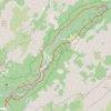
Mirror Lake and Valley Loop Trail in Yosemite National Park
United States > California > Mariposa County > Curry Village
The Mirror Lake and Valley Loop Trail in Yosemite National Park offers hikers stunning views of Tenaya Canyon, Mount Watkins, and the Washington Column, all beneath the iconic Half Dome. This relatively easy trail winds through lush forests and along the tranquil Tenaya Creek, leading to Mirror Lake, which…
Distance: 4.5 mi • Elevation gain: 443 ft • Maximum elevation: 4,190 ft
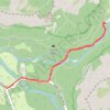
Mirror Lake Trail in Yosemite National Park
United States > California > Mariposa County > Curry Village
The Mirror Lake Trail in Yosemite National Park offers a peaceful hike through Tenaya Canyon, framed by dramatic granite cliffs like Half Dome and North Dome. The trail winds alongside Tenaya Creek, providing a serene experience with forested sections, sandy riverbeds, and seasonal reflections in the lake,…
Distance: 2.8 mi • Elevation gain: 230 ft • Maximum elevation: 4,124 ft

Clouds Rest Trail in Yosemite National Park
United States > California > Mariposa County
The Clouds Rest Trail in Yosemite offers hikers a rewarding, strenuous challenge with breathtaking views throughout. As you ascend, the landscape transforms from lush forest to open granite ridgelines, with expansive vistas of Tenaya Lake and the iconic Half Dome in the distance. The final approach to the…
Distance: 12.6 mi • Elevation gain: 2,864 ft • Maximum elevation: 9,813 ft
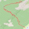
Columbia Rock Trail via Upper Yosemite Fall Trail in Yosemite National Park
United States > California > Mariposa County > Yosemite Village > Yosemite Lodge
The Columbia Rock Trail, accessible via the Upper Yosemite Fall Trail, offers hikers a rewarding ascent through oak woodlands and granite switchbacks. Upon reaching Columbia Rock, you're greeted with panoramic views of Yosemite Valley, including iconic landmarks like Half Dome and Sentinel Rock. For those…
Distance: 1.9 mi • Elevation gain: 1,211 ft • Maximum elevation: 5,023 ft
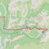
Nevada Fall via Mist Trail and Vernal Fall in Yosemite National Park
United States > California > Mariposa County > Curry Village
Hiking the Mist Trail to Nevada Fall in Yosemite National Park offers an exhilarating journey through some of the park's most iconic landscapes. As you ascend, you'll first encounter the mesmerizing Vernal Fall, with its cascading waters often creating vibrant rainbows in the mist. Continuing upward, the trail…
Distance: 6.1 mi • Elevation gain: 2,480 ft • Maximum elevation: 6,007 ft
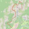
Yosemite Point via Upper Yosemite Fall Trail in Yosemite National Park
United States > California > Mariposa County > Yosemite Lodge
The Upper Yosemite Falls Trail to Yosemite Point is a strenuous hike that offers hikers panoramic views of Yosemite Valley, including iconic landmarks such as Half Dome and the Cathedral Spires. Along the ascent, the trail provides close-up perspectives of the majestic Upper Yosemite Falls—one of the tallest…
Distance: 8.6 mi • Elevation gain: 5,823 ft • Maximum elevation: 7,014 ft
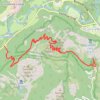
Four Mile Trail to Glacier Point and Union Point in Yosemite National Park
United States > California > Mariposa County > Yosemite Village > Yosemite Lodge
The Four Mile Trail in Yosemite National Park offers hikers a strenuous ascent from Yosemite Valley to Glacier Point, providing panoramic views of iconic landmarks. Along the route, hikers can observe the grandeur of El Capitan and Yosemite Falls, the expansive vistas of Yosemite Valley, and the impressive…
Distance: 10.0 mi • Elevation gain: 5,489 ft • Maximum elevation: 7,208 ft
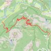
Glacier Point via Four Mile Trail in Yosemite National Park
United States > California > Mariposa County > Yosemite Village > Yosemite Lodge
Hiking the Four-Mile Trail to Glacier Point offers some of the best views in Yosemite National Park, with expansive vistas unfolding gradually as you ascend. Along the way, hikers can admire iconic landmarks like Yosemite Falls, El Capitan, and Half Dome, as well as the deep reaches of Tenaya Canyon. Though…
Distance: 4.7 mi • Elevation gain: 4,114 ft • Maximum elevation: 7,244 ft
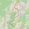
Upper Yosemite Fall Trail in Yosemite National Park
United States > California > Mariposa County > Yosemite Village > Yosemite Lodge
The Upper Yosemite Fall Trail is a demanding hike that rewards adventurers with breathtaking panoramic views of Yosemite Valley, Half Dome, and the mighty Yosemite Falls. As you ascend, you'll pass through diverse terrain, from oak forests and steep switchbacks to open sections offering sweeping vistas. The…
Distance: 6.3 mi • Elevation gain: 4,925 ft • Maximum elevation: 6,690 ft