
Indiana_to_florida
- Distance: 655.1 mi
- Elevation gain: 28,825 ft
- Maximum elevation: 1,122 ft
- Elevation loss: 29,383 ft
- Minimum elevation: 7 ft
Interactive trail map
Trail profile
- Distance: 655.1 mi
- Elevation gain: 28,825 ft
- Maximum elevation: 1,122 ft
- Elevation loss: 29,383 ft
- Minimum elevation: 7 ft
About this trail
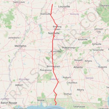
Name: Indiana_to_florida trail, distance, elevation, map, profile, GPS track
Start: 6570, US 231, Martin County, Indiana, 47553, United States (38.59108 -86.91001)
Coordinates: 30.43436 -87.07638 38.59108 -86.32119
Topography: Martin County topographic map, elevation, terrain
Other hiking, mountain biking, running and outdoor activity trails
Click on a trail to view its statistics, map and profile.
New MTB Trail on Land Trust called Winding Cedar Trail
United States > Alabama > Madison County > Huntsville
Distance: 7.3 mi • Elevation gain: 879 ft • Maximum elevation: 1,614 ft
Monte Sano Mountain Loop via Sinks Trail, Stone Cuts Trail and North Plateau Loop
United States > Alabama > Madison County > Huntsville
The Monte Sano Mountain Loop offers an invigorating hike through diverse terrain and striking features. The loop showcases impressive rock formations and limestone cliffs, particularly along the Stone Cuts Trail, where hikers are enveloped by towering stone walls. Along the way, views open up to expansive…
Distance: 2.5 mi • Elevation gain: 515 ft • Maximum elevation: 1,631 ft
Singing River Trail / Tennessee River Greenway
United States > Alabama > Madison County > Huntsville
Distance: 10.1 mi • Elevation gain: 220 ft • Maximum elevation: 584 ft
King's Chair Overlook Loop from North Trailhead via Red Road and Blue Trail
United States > Alabama > Shelby County > Pelham
The King's Chair Overlook Loop is a rewarding hike that leads to one of the Oak Mountain State Park's most iconic views. As you navigate the Red Road and Blue Trail, you'll pass through lush hardwood forests and rocky terrain, with occasional glimpses of the park’s expansive vistas. The final destination,…
Distance: 4.6 mi • Elevation gain: 768 ft • Maximum elevation: 1,145 ft
King's Chair Overlook via Red and Blue Trails in Oak Mountain State Park
United States > Alabama > Shelby County > Pelham
The King's Chair Overlook hike offers hikers an opportunity to experience stunning panoramic views of the surrounding landscapes, especially to the south of Birmingham. The route is characterized by a moderate difficulty, with a steep initial climb that gives way to more manageable terrain, rewarding visitors…
Distance: 3.4 mi • Elevation gain: 617 ft • Maximum elevation: 1,145 ft

Rainbow Loop Trail in Rainbow Mountain Preserve
United States > Alabama > Madison County > Madison > Stone Ridge
The Rainbow Loop Trail offers a moderately challenging experience with a mix of rocky terrain, gentle inclines, and beautiful scenery. Hikers can enjoy sweeping views of Madison while descending into peaceful woodland areas, passing by multiple caves, springs, and diverse plant life along the way. The trail…
Distance: 1.5 mi • Elevation gain: 331 ft • Maximum elevation: 1,115 ft

Redstone Arsenal Weeden Mountain and Madkin Mountain trails
United States > Alabama > Madison County
RSA
Distance: 9.4 mi • Elevation gain: 919 ft • Maximum elevation: 1,027 ft

Arrowhead Trail and Natural Well Trail Loop in Monte Sano State Park
United States > Alabama > Madison County > Huntsville > Mountain Heights
Arrowhead
Distance: 7.6 mi • Elevation gain: 1,217 ft • Maximum elevation: 1,516 ft
South Plateau MTB Loop
United States > Alabama > Madison County > Huntsville
Distance: 6.2 mi • Elevation gain: 472 ft • Maximum elevation: 1,650 ft

Rocket City Half Marathon
United States > Alabama > Madison County > Huntsville
Distance: 13.2 mi • Elevation gain: 413 ft • Maximum elevation: 686 ft

Legacy Loop Trail
United States > Alabama > Madison County > Huntsville > Hawks Ridge
Distance: 2.0 mi • Elevation gain: 305 ft • Maximum elevation: 1,083 ft

Bankhead Trail and Oak Park Trail MTB Ride in Monte Sano Nature Preserve
United States > Alabama > Madison County > Huntsville > Hawks Ridge
Distance: 2.8 mi • Elevation gain: 138 ft • Maximum elevation: 1,352 ft

Blevins Gap Nature Preserve loop
United States > Alabama > Madison County > Huntsville > Ridgewood
Distance: 8.3 mi • Elevation gain: 1,421 ft • Maximum elevation: 1,503 ft

Loop hike via Jones Valley Loop, Bailey Cove, Walsingham, Fanning and unnamed trails in Blevins Preserve
United States > Alabama > Madison County > Huntsville
Distance: 3.8 mi • Elevation gain: 741 ft • Maximum elevation: 1,371 ft
Fanning, Stevenson, Walsingham, Bailey Cove, and Jones Valley Loop trails
United States > Alabama > Madison County > Huntsville
Distance: 2.0 mi • Elevation gain: 469 ft • Maximum elevation: 1,220 ft
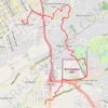
Walking Five Points, Highland Park, Key Circle, Botanical Gardens, Mountain Brook Village
United States > Alabama > Jefferson County > Birmingham > Five Points South
Distance: 5.7 mi • Elevation gain: 515 ft • Maximum elevation: 971 ft
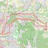
25 mile Bike Ride, Huntsville/Gurley AL
United States > Alabama > Madison County > Huntsville > Five Points
Moontown Airport
Distance: 25.2 mi • Elevation gain: 1,237 ft • Maximum elevation: 1,007 ft

Big Canoe Creek Nature Preserve
United States > Alabama > St. Clair County > Springville
Distance: 1.7 mi • Elevation gain: 220 ft • Maximum elevation: 883 ft
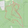
McKay Trail/Monte Sano State Park (MSSP) ride
United States > Alabama > Madison County > Huntsville
Distance: 9.0 mi • Elevation gain: 1,060 ft • Maximum elevation: 1,647 ft

Big Canoe Creek Nature Preserve Loop Walk
United States > Alabama > St. Clair County > Springville
Distance: 2.7 mi • Elevation gain: 256 ft • Maximum elevation: 883 ft

Goldsmith-Shiffman Wildlife Sanctuary Loop
United States > Alabama > Madison County > Huntsville
Distance: 3.6 mi • Elevation gain: 46 ft • Maximum elevation: 597 ft

Trails at Peacock Hill Nature Park
United States > Tennessee > Williamson County
Distance: 3.2 mi • Elevation gain: 469 ft • Maximum elevation: 1,155 ft
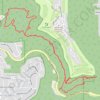
Jones Valley Loop, Bailey Cove, Fanning, Scout, and in-progress Bailey Cove extension trails
United States > Alabama > Madison County > Huntsville > Huntsville Hills
Distance: 7.4 mi • Elevation gain: 1,243 ft • Maximum elevation: 1,378 ft
Toll Gate Greenway MTB in Monte Sano State Park
United States > Alabama > Madison County > Huntsville > Oak Park
Distance: 2.6 mi • Elevation gain: 538 ft • Maximum elevation: 1,460 ft

Big Canoe Creek Nature Preserve Loop Trail
United States > Alabama > St. Clair County > Springville
Distance: 4.6 mi • Elevation gain: 682 ft • Maximum elevation: 994 ft
Fanning Trail in Blevins Gap Preserve
United States > Alabama > Madison County > Huntsville > Huntsville Hills
Distance: 5.3 mi • Elevation gain: 951 ft • Maximum elevation: 1,342 ft

Peacock Hill Nature Park Trails loop
United States > Tennessee > Williamson County
Distance: 4.0 mi • Elevation gain: 633 ft • Maximum elevation: 1,155 ft

Loop Run - Running - Nashville, TN
United States > Tennessee > Davidson County > Nashville-Davidson
Lunch Run
Distance: 3.7 mi • Elevation gain: 157 ft • Maximum elevation: 636 ft
Bradford Creek Greenway
United States > Alabama > Madison County > Madison
Distance: 5.0 mi • Elevation gain: 121 ft • Maximum elevation: 705 ft
Moss Rock Preserve
United States > Alabama > Jefferson County > Hoover
Distance: 1.6 mi • Elevation gain: 98 ft • Maximum elevation: 673 ft
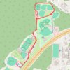
Oneonta Recreation Park Loop Run
United States > Alabama > Blount County > Oneonta
Distance: 2.8 mi • Elevation gain: 246 ft • Maximum elevation: 886 ft
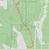
Warpath Ridge MTB Trail
United States > Alabama > Madison County > Huntsville
Distance: 4.5 mi • Elevation gain: 102 ft • Maximum elevation: 1,637 ft
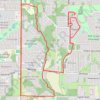
Bicycle-Madison AL
United States > Alabama > Madison County > Madison
Afternoon Ride
Distance: 10.3 mi • Elevation gain: 338 ft • Maximum elevation: 728 ft
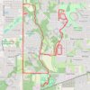
13 Mile Bike, Madison, AL
United States > Alabama > Madison County > Madison
Distance: 13.0 mi • Elevation gain: 420 ft • Maximum elevation: 728 ft
10 Mile Run, Madison AL
United States > Alabama > Madison County > Madison
Lunch Run
Distance: 10.2 mi • Elevation gain: 328 ft • Maximum elevation: 728 ft
Monte Sano Loop Ride
United States > Alabama > Madison County > Huntsville
Afternoon Mountain Bike Ride
Distance: 8.1 mi • Elevation gain: 932 ft • Maximum elevation: 1,614 ft
Bradford Creek Greenway
United States > Alabama > Madison County > Madison
Distance: 4.5 mi • Elevation gain: 121 ft • Maximum elevation: 702 ft

South Horton Inner Loop
United States > Tennessee > Marshall County
Distance: 4.0 mi • Elevation gain: 157 ft • Maximum elevation: 741 ft
Honeycomb Trail Complete
United States > Alabama > Marshall County > Cottonville
Distance: 8.8 mi • Elevation gain: 1,453 ft • Maximum elevation: 856 ft
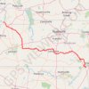
Gmaps Pedometer Route
United States > Kentucky > Fulton County > Hickman
Distance: 312.5 mi • Elevation gain: 13,793 ft • Maximum elevation: 1,942 ft
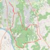
Green Mountain Loop Ride
United States > Alabama > Madison County > Huntsville > Willow Hills Estates
Distance: 31.4 mi • Elevation gain: 1,752 ft • Maximum elevation: 1,460 ft
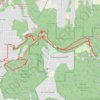
Land Trust Ride
United States > Alabama > Madison County > Huntsville
Distance: 11.8 mi • Elevation gain: 1,578 ft • Maximum elevation: 1,621 ft

Tally-Ho Trail
United States > Alabama > Madison County > Huntsville
Distance: 0.6 mi • Elevation gain: 23 ft • Maximum elevation: 1,604 ft
Turkey Creek
United States > Alabama > Jefferson County > Pinson
Distance: 0.4 mi • Elevation gain: 62 ft • Maximum elevation: 597 ft