
Cottonwood Trail trails
Click on a trail to view its statistics, map and profile.
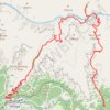
Grand Canyon Rim to River
United States > Arizona > Coconino County
From the South Kaibab Trailhead, this rim-to-river route immediately commits to one of the Grand Canyon’s most open and scenic descents, following a ridgeline where the canyon unfolds in wide layers of buttes, cliffs and side canyons. The trail passes Ooh Aah Point, Cedar Ridge, Skeleton Point and The Tipoff…
Distance: 16.9 mi • Elevation gain: 7,359 ft • Maximum elevation: 7,221 ft
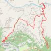
South Kaibab - Tonto - Bright Angel (Grand Canyon)
United States > Arizona > Coconino County
From Yaki Point, the route commits at once to the exposed descent of the South Kaibab Trail, a dramatic ridgeline path known for wide, open views and very little shade or water. It first reaches Ooh Aah Point, where the canyon opens suddenly in every direction, then continues through the sculpted upper…
Distance: 18.7 mi • Elevation gain: 7,523 ft • Maximum elevation: 7,274 ft
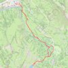
Cecret Lake Trail via Upper Albion Meadows Trail in Uinta-Wasatch-Cache National Forest
United States > Utah > Salt Lake County > Alta
The hike to Cecret Lake via the Upper Albion Meadows Trail offers a peaceful journey through colorful wildflower meadows, leading to a serene alpine lake surrounded by striking rocky cliffs. As you ascend, you’ll be treated to views of Albion Basin, where vibrant summer wildflowers and the chance to spot…
Distance: 4.6 mi • Elevation gain: 1,194 ft • Maximum elevation: 9,875 ft
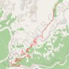
Indian Garden (Grand Canyon)
United States > Arizona > Coconino County > Grand Canyon Village
From Grand Canyon Village on the South Rim, the route drops onto the Bright Angel Trail, passing the rim-side trailhead, the upper tunnel, Mallery’s Grotto pictographs, and the second tunnel as the path enters a shaded side canyon framed by high cliffs. The descent continues through long switchbacks and…
Distance: 4.7 mi • Elevation gain: 1,112 ft • Maximum elevation: 6,841 ft
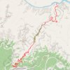
Pipe Creek Beach via Bright Angel Trail
United States > Arizona > Coconino County > Grand Canyon Village
From Grand Canyon Village on the South Rim, this route begins at the Bright Angel Trailhead and descends beneath the rim through a dramatic chain of switchbacks, with widening views across the canyon walls and the layered cliffs of the Bright Angel fault corridor. It passes the resthouse section of the upper…
Distance: 15.7 mi • Elevation gain: 7,300 ft • Maximum elevation: 6,841 ft
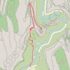
Angels Landing
United States > Utah > Washington County > Zion Lodge
From the Zion Canyon floor near the Virgin River, the Angels Landing route follows the West Rim Trail away from The Grotto, climbing quickly above the cottonwoods and canyon walls with widening views toward landmarks such as The Organ, the Great White Throne, and the surrounding sandstone cliffs of Zion…
Distance: 4.6 mi • Elevation gain: 2,513 ft • Maximum elevation: 5,515 ft
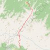
Grand Canyon Rim to Rim Hike on South Kaibab Trail and North Kaibab Trail
United States > Arizona > Coconino County
From the South Kaibab Trailhead, this rim-to-rim hike drops from the South Rim into the open canyon on the South Kaibab Trail, passing Ooh Aah Point, Cedar Ridge, Skeleton Point and Tipoff Shelter before reaching the Kaibab Suspension Bridge, the Colorado River and the Bright Angel area near Phantom Ranch. The…
Distance: 20.8 mi • Elevation gain: 9,423 ft • Maximum elevation: 8,258 ft

Thunderbird Falls Trail in Chugach State Park
United States > Alaska > Anchorage
The Thunderbird Falls Trail offers a delightful experience for hikers of all levels! As you stroll along the well-maintained path, you'll be surrounded by vibrant cottonwood and birch trees, and you'll enjoy stunning views of the breathtaking 200-foot waterfall cascading into the canyon below. Don't forget to…
Distance: 1.8 mi • Elevation gain: 430 ft • Maximum elevation: 325 ft
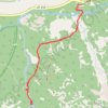
Gloria Falls
United States > Utah > Salt Lake County
The hike to Gloria Falls takes you through a peaceful forest setting, following a well-trodden trail along a creek, with beautiful views of surrounding ridges. Though some sections are a bit rocky, the gradual incline makes it accessible for most hikers, including beginners. At the end, the trail rewards you…
Distance: 2.6 mi • Elevation gain: 646 ft • Maximum elevation: 8,258 ft
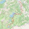
Lake Catherine Loop
United States > Utah > Salt Lake County > Brighton
Starting at Brighton Resort in Big Cottonwood Canyon, the loop leaves the ski-area base and climbs into the Brighton Lakes corridor, crossing open slopes, conifer patches, and a stream-fed drainage on the way toward Lake Mary. Beyond the dam and shoreline of Lake Mary, the route continues into a higher alpine…
Distance: 4.7 mi • Elevation gain: 1,224 ft • Maximum elevation: 9,957 ft

Lake Blanche Trail and Lake Blanche Loop in the Twin Peaks Wilderness
United States > Utah > Salt Lake County
The Lake Blanche Trail offers a challenging ascent that rewards hikers with breathtaking views of Sundial Peak and the expansive valley below unfold. As you make your way up the rocky path, the serene beauty of Lake Blanche awaits at the top, surrounded by stunning vistas that make every effort worthwhile.…
Distance: 7.7 mi • Elevation gain: 2,802 ft • Maximum elevation: 8,976 ft
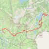
Lake Mary Dam via Catherine's Pass Trail
United States > Utah > Salt Lake County > Alta
The Lake Mary Dam hike via Catherine’s Pass Trail offers a scenic and rewarding journey through the Uinta-Wasatch-Cache National Forest. Along the way, you'll encounter picturesque alpine lakes such as Lake Mary, Lake Martha, and Lake Catherine, with stunning views of rugged peaks like Mount Millicent. The…
Distance: 6.2 mi • Elevation gain: 1,765 ft • Maximum elevation: 10,223 ft
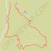
Franklin Mountains State Park - Aztec Cave Trail to Mundy's Gap, West Cottonwood, Agave Loop
United States > Texas > El Paso County > El Paso
Hiking
Distance: 4.6 mi • Elevation gain: 1,175 ft • Maximum elevation: 5,902 ft

Borrego Springs - Rockhouse Canyon
United States > California > San Diego County
Hike through the Rockhouse Canyon to the Cottonwood Springs via Rockhouse Trail, Hidden Springs, in the Santa Rosa Wilderness and the Anza-Borrego Desert State Park. #Hiking #Loop #Mountain #Canyon #Nature #Desert #Wilderness #Park
Distance: 13.4 mi • Elevation gain: 2,116 ft • Maximum elevation: 3,136 ft

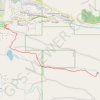


Lake Blanche Trail
United States > Utah > Salt Lake County
Distance: 7.8 mi • Elevation gain: 2,802 ft • Maximum elevation: 8,911 ft

Manzano Peak Loop via Cottonwood Trail, Pine Shadow Trail and Kayser Mill Trail
United States > New Mexico > Torrance County
Distance: 11.8 mi • Elevation gain: 3,205 ft • Maximum elevation: 9,915 ft

Little Cottonwood Trail
United States > Utah > Cache County
Hiking
Distance: 6.9 mi • Elevation gain: 1,171 ft • Maximum elevation: 6,624 ft
Cottonwood Trail
United States > North Carolina > Cleveland County
Distance: 7.7 mi • Elevation gain: 492 ft • Maximum elevation: 807 ft

Hiking Jardine
United States > Utah > Cache County > Brachipad Summer Home Area
Distance: 3.6 mi • Elevation gain: 1,624 ft • Maximum elevation: 6,969 ft