
San Juan County trails
Click on a trail to view its statistics, map and profile.

Mount Young and Briggs Lake loop hike in Roche Harbour Highlands Watershed
United States > Washington > San Juan County
Distance: 4.5 mi • Elevation gain: 689 ft • Maximum elevation: 643 ft
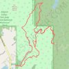
Outer Limits Trail
United States > Washington > San Juan County
Distance: 4.4 mi • Elevation gain: 650 ft • Maximum elevation: 525 ft
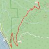
Oyster Dome Trail in Blanchard State Forest
United States > Washington > Skagit County > Samish
The Oyster Dome Trail, accessed via Chuckanut Drive and the Samish Bay Connector, offers hikers a rewarding journey through Blanchard State Forest. The path meanders through lush forests of alder, cedar, and Douglas fir, with occasional views of the Salish Sea and the Olympic Peninsula. The trail culminates at…
Distance: 6.7 mi • Elevation gain: 2,014 ft • Maximum elevation: 1,991 ft
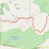
Beaverton Marsh Preserve
United States > Washington > San Juan County
Distance: 2.6 mi • Elevation gain: 259 ft • Maximum elevation: 171 ft
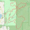
Mitchell Hill Trails
United States > Washington > San Juan County
Distance: 8.6 mi • Elevation gain: 1,348 ft • Maximum elevation: 604 ft
Bear Creek Falls Trail in Uncompahgre National Forest
United States > Colorado > San Miguel County > Telluride
The Bear Creek Trail, starting from Telluride, offers hikers a scenic journey through diverse landscapes. Along the way, you'll encounter dense forests, open meadows, and panoramic vistas of the surrounding rugged peaks of the San Juan Mountains. The trail culminates at the impressive Bear Creek Falls, where…
Distance: 4.6 mi • Elevation gain: 1,201 ft • Maximum elevation: 9,954 ft
Mitchell Hill Mountain Bike
United States > Washington > San Juan County
Distance: 5.2 mi • Elevation gain: 597 ft • Maximum elevation: 499 ft

San Juan Hot Springs
United States > California > Orange County
From Ortega Flats Campground in Ronald W. Caspers Wilderness Park, the hike leaves the camping area and enters the San Juan Creek corridor, following a quiet canyon setting shaped by seasonal water, riparian vegetation, oak woodland, and chaparral-covered slopes. The route continues upstream along San Juan…
Distance: 10.2 mi • Elevation gain: 1,247 ft • Maximum elevation: 814 ft
Lawsonite Trail up and down
United States > Washington > San Juan County
Distance: 1.5 mi • Elevation gain: 384 ft • Maximum elevation: 722 ft
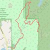
Mitchell Hill
United States > Washington > San Juan County
Distance: 2.5 mi • Elevation gain: 538 ft • Maximum elevation: 525 ft

Mesa Arch Loop Trail in Canyonlands National Park
United States > Utah > San Juan County
The Mesa Arch Trail in Canyonlands National Park offers hikers a brief and accessible loop leading to the stunning Mesa Arch, a natural stone arch perched at the edge of a cliff. This formation frames expansive views of the rugged canyons below and the distant La Sal Mountains. The trail's minimal elevation…
Distance: 0.7 mi • Elevation gain: 92 ft • Maximum elevation: 6,188 ft
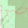
Mitchell Hill up
United States > Washington > San Juan County
Distance: 2.7 mi • Elevation gain: 499 ft • Maximum elevation: 518 ft
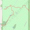
Mitchell Hill via North Trail
United States > Washington > San Juan County
Distance: 1.5 mi • Elevation gain: 522 ft • Maximum elevation: 512 ft
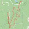
Mount Grant via Lawsonite Trail and Graywacke Trail
United States > Washington > San Juan County
Distance: 2.4 mi • Elevation gain: 446 ft • Maximum elevation: 728 ft
Grand View Point Trail in Canyonlands National Park
United States > Utah > San Juan County
The Grand View Point Trail in Canyonlands National Park offers hikers breathtaking vistas of the expansive canyons and mesas that define the Island in the Sky district. As you traverse the trail, you'll encounter panoramic views of the White Rim Road, the confluence of the Colorado and Green Rivers, and…
Distance: 2.0 mi • Elevation gain: 1,342 ft • Maximum elevation: 6,296 ft
Lawsonite Trail and Greenwake Trail Loop below Mount Grant
United States > Washington > San Juan County
Distance: 1.8 mi • Elevation gain: 364 ft • Maximum elevation: 692 ft

Oyster Dome Trail via Samish Bay Connector in Blanchard State Forest
United States > Washington > Skagit County > Samish
The Oyster Dome Trail offers a scenic and moderately challenging hike with rewarding views throughout. Starting from Samish Overlook, the route ascends through lush vegetation, including towering Douglas firs and cedar trees, leading hikers past impressive remnants of historical logging. Upon reaching the…
Distance: 4.3 mi • Elevation gain: 1,214 ft • Maximum elevation: 1,991 ft

Lawsonite Trail up
United States > Washington > San Juan County
Distance: 0.8 mi • Elevation gain: 318 ft • Maximum elevation: 689 ft
Oyster Dome via Chuckanut Trail and Samish Bay Connector in Blanchard State Forest
United States > Washington > Skagit County > Samish
The hike to Oyster Dome is a rewarding journey through the serene Blanchard State Forest. The route begins with steady switchbacks, winding through a lush canopy of Douglas fir, maple, and cedar, offering moments of tranquility punctuated by expansive views over Samish Bay. Upon reaching the rocky summit,…
Distance: 6.2 mi • Elevation gain: 1,988 ft • Maximum elevation: 1,982 ft


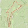


Mountain Biking - Bohanon Canyon Complex Fossil Area Loop
United States > New Mexico > San Juan County
Distance: 29.0 mi • Elevation gain: 2,930 ft • Maximum elevation: 6,877 ft

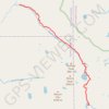
Rock Lake and Moon Lake via Rock Creek Trail
United States > Colorado > San Juan County
Wilderness hike
Distance: 6.2 mi • Elevation gain: 2,365 ft • Maximum elevation: 12,507 ft

Ship Peak Loop via Morning Ridge and Lost Oak trails
United States > Washington > San Juan County
Turtleback Mountain Preserve
Distance: 2.5 mi • Elevation gain: 502 ft • Maximum elevation: 922 ft


Bell Point Loop Trail in San Juan Island National Historical Park
United States > Washington > San Juan County
Distance: 1.6 mi • Elevation gain: 226 ft • Maximum elevation: 108 ft

Honaker trail from San Juan River
United States > Utah > San Juan County
Distance: 6.0 mi • Elevation gain: 3,304 ft • Maximum elevation: 5,174 ft

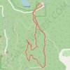
Greywacke Trail, Subduction Loop and Geraldine Lane loop walk in Mount Grant Preserve
United States > Washington > San Juan County
Distance: 1.2 mi • Elevation gain: 167 ft • Maximum elevation: 489 ft

Shafer Trail
United States > Utah > Grand County
Moab, UT - Shafer Trail
Distance: 20.4 mi • Elevation gain: 4,852 ft • Maximum elevation: 5,919 ft
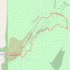
Mitchell Hill Center Trail and Inner Loop Road
United States > Washington > San Juan County
Distance: 0.9 mi • Elevation gain: 151 ft • Maximum elevation: 236 ft

Crescent Beach Preserve
United States > Washington > San Juan County > Eastsound
Distance: 1.9 mi • Elevation gain: 180 ft • Maximum elevation: 69 ft

Rock Creek Down
United States > Colorado > Hinsdale County
Wilderness hike
Distance: 11.0 mi • Elevation gain: 2,487 ft • Maximum elevation: 12,507 ft
Geraldine Lane in Mount Grant Preserve
United States > Washington > San Juan County
Distance: 1.3 mi • Elevation gain: 95 ft • Maximum elevation: 404 ft