
Slope County trails
Click on a trail to view its statistics, map and profile.
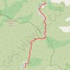
Bridge to Nowhere
United States > California > Los Angeles County
From Bridge to Nowhere Trailhead near Coyote Flat, the route enters Sheep Mountain Wilderness on the East Fork Trail and follows the East Fork of the San Gabriel River into a steep San Gabriel Mountains canyon of chaparral slopes, gravel bars and bouldery riverbank. The path continues upstream along the rocky…
Distance: 9.5 mi • Elevation gain: 1,785 ft • Maximum elevation: 2,835 ft
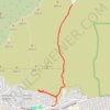
Hall Canyon
United States > California > Ventura County > San Buenaventura (Ventura)
From Hall Canyon Road, the route enters Ventura Hills Nature Preserve and follows the quiet canyon corridor between open foothill slopes. It continues along dry washes and coastal scrub typical of Ventura’s protected hillside landscape. The walk reaches the split between West Fork Hall Canyon and East Fork…
Distance: 4.7 mi • Elevation gain: 633 ft • Maximum elevation: 430 ft
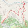
South Kaibab - Tonto - Bright Angel (Grand Canyon)
United States > Arizona > Coconino County
From Yaki Point, the route commits at once to the exposed descent of the South Kaibab Trail, a dramatic ridgeline path known for wide, open views and very little shade or water. It first reaches Ooh Aah Point, where the canyon opens suddenly in every direction, then continues through the sculpted upper…
Distance: 18.7 mi • Elevation gain: 7,523 ft • Maximum elevation: 7,274 ft
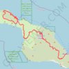
Trans Catalina Trail (TCT)
United States > California > Los Angeles County > Avalon > Pebbly Beach
The Trans-Catalina Trail begins in Avalon, leaving the island’s lively harbor town to climb into the dry, rugged interior of Santa Catalina Island. The route passes Haypress Reservoir and Cape Canyon Reservoir before entering the Black Jack backcountry and continuing toward Catalina Airport, often known as…
Distance: 38.7 mi • Elevation gain: 9,272 ft • Maximum elevation: 1,742 ft
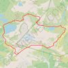
Chain Lakes Loop Trail
United States > Washington > Whatcom County
The Chain Lakes Loop Trail explores the dramatic alpine landscape of the Mount Baker–Snoqualmie National Forest, beginning here at Artist Point beneath the steep southern slopes of Table Mountain. The trail initially traverses open heather meadows and rocky terrain, with broad views toward Mount Baker, Mount…
Distance: 5.7 mi • Elevation gain: 1,972 ft • Maximum elevation: 5,472 ft
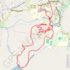
Wildcat Lake and Hemlock Hill Loop
United States > North Carolina > Avery County > Banner Elk
Starting in Banner Elk, the loop heads out through town to Mill Pond, where calm water and a pleasant valley setting introduce the walk before the route turns toward the grounds of Lees-McRae College. From there, the itinerary continues across the college area and down to Wildcat Lake, a scenic lakeside…
Distance: 4.7 mi • Elevation gain: 686 ft • Maximum elevation: 3,871 ft
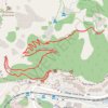
1.5 Mile Resthouse (Grand Canyon)
United States > Arizona > Coconino County > Grand Canyon Village
From Grand Canyon Village, the route leaves the rim near Bright Angel Lodge and drops onto the Bright Angel Trail, quickly entering the shaded upper canyon through tight switchbacks and broad South Rim viewpoints. The path continues across pale cliffs, wooded pockets and exposed canyon slopes, following one of…
Distance: 1.6 mi • Elevation gain: 630 ft • Maximum elevation: 6,841 ft
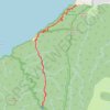
Hanakapi'ai Falls (Kauai Island)
United States > Hawaii > Kauaʻi County
Starting at Kēʻē Beach in Hāʻena State Park, this out-and-back hike follows the Kalalau Trail above the Pacific, leaving the coastal edge of the park to reveal the first broad views of the Nā Pali Coast, with ocean, reef, sea cliffs, and tropical vegetation appearing in succession along the way. The…
Distance: 7.9 mi • Elevation gain: 3,871 ft • Maximum elevation: 1,342 ft
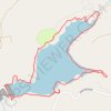
Sugar Pine Reservoir Loop
United States > California > Placer County
Starting near the Sugar Pine boat-ramp area, this anti-clockwise loop follows the Joshua M. Hardt Memorial Trail along the eastern shore of Sugar Pine Reservoir, with broad lake views, wooded slopes and the quiet backdrop of Tahoe National Forest. The route then rounds the northern coves and inlets, passing…
Distance: 4.4 mi • Elevation gain: 528 ft • Maximum elevation: 3,717 ft
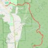
Poo-Poo Point Trail
United States > Washington > King County > Issaquah
Starting near the Issaquah High School side of West Tiger Mountain, the trail enters a shaded forest and climbs steadily through the lower slopes of the natural resources conservation area. It then follows the wooded Poo Poo Point route, passing small creek draws and mossy woodland before reaching the open…
Distance: 6.9 mi • Elevation gain: 2,142 ft • Maximum elevation: 1,847 ft
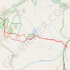
Mount Washington, Lion Head and Tuckerman Ravine Loop
United States > New Hampshire > Coos County
From Pinkham Notch, the route enters the White Mountain National Forest on the Tuckerman Ravine Trail, climbing through dense northern hardwood and conifer forest beside the Cutler River. An early highlight is Crystal Cascade, where the stream drops through a rocky gorge, before the trail continues steadily…
Distance: 7.8 mi • Elevation gain: 4,347 ft • Maximum elevation: 6,270 ft
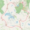
Desolation Wilderness 7 Summits Loop Hike
United States > California > El Dorado County
Starting from Glen Alpine Road near Fallen Leaf Lake, this demanding high-country loop enters the southern Desolation Wilderness beneath Angora Peak and sweeps south and west through granite terrain toward Ralston Peak. The climb gradually opens views across the Echo Lakes country, Fallen Leaf Lake and the…
Distance: 24.0 mi • Elevation gain: 9,698 ft • Maximum elevation: 9,954 ft
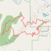
Turkey Trot Trail Loop via Castle Trail in Mount Falcon Park
United States > Colorado > Jefferson County > Morrison
From the Morrison Trailhead, the route starts on Castle Trail, leaving the edge of town for open foothill slopes, switchbacks and early views toward Red Rocks and the Denver skyline. It then joins Turkey Trot Trail, a hiker-focused section that climbs and contours through quieter pine, scrub and rocky hillside…
Distance: 3.4 mi • Elevation gain: 919 ft • Maximum elevation: 6,788 ft
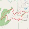
Turkey Trot Trail Loop
United States > Colorado > Jefferson County > Morrison
From the Mount Falcon Morrison Trailhead, the route sets out on Turkey Trot Trail above Vine Street, leaving the park edge for open foothill slopes, low scrub, and scattered pines with early views toward Morrison, Red Rocks Park, and the Denver plain. It continues west on Turkey Trot Trail as the loop wraps…
Distance: 3.3 mi • Elevation gain: 902 ft • Maximum elevation: 6,788 ft
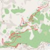
3 Mile Resthouse (Grand Canyon)
United States > Arizona > Coconino County > Grand Canyon Village
From Grand Canyon Village, the route leaves the South Rim at the Bright Angel Trailhead near the historic rim area and drops onto the Bright Angel Trail, one of the park’s classic corridor trails, used through time by Indigenous peoples, miners, early tourists, hikers, and mule parties. The descent quickly…
Distance: 3.0 mi • Elevation gain: 860 ft • Maximum elevation: 6,841 ft
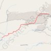
Delicate Arch
United States > Utah > Grand County
Starting at the Delicate Arch Trailhead, the route leaves the parking area near Salt Wash and follows Delicate Arch Trail past the historic Wolfe Ranch area and the nearby Ute Indian petroglyph panel. From there, it heads into open desert terrain, crossing shallow drainages and moving away from the easier…
Distance: 3.2 mi • Elevation gain: 636 ft • Maximum elevation: 4,820 ft
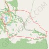
Naches Peak Loop
United States > Washington > Pierce County
Starting from the Tipsoo Lake area, the loop climbs toward Chinook Pass, crosses the highway footbridge, and joins the Pacific Crest Trail as it skirts the north and east side of Naches Peak through subalpine forest, open slopes, and small mountain ponds. The route then bends around the quieter eastern…
Distance: 3.3 mi • Elevation gain: 673 ft • Maximum elevation: 5,883 ft
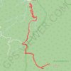
The Priest via Crabtree Falls
United States > Virginia > Nelson County
Starting at Crabtree Falls, the route climbs the switchbacking Crabtree Falls Trail beside Crabtree Creek, passing a succession of cascades, rock ledges, forested slopes and valley overlooks before reaching the quieter upper creek area near Crabtree Meadows. It then continues through a more remote mountain…
Distance: 9.5 mi • Elevation gain: 2,953 ft • Maximum elevation: 4,012 ft
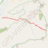
Icehouse Saddle via Icehouse Canyon
United States > California > San Bernardino County
Starting from the Icehouse Canyon Trailhead near Mount Baldy Road, the route climbs into the shaded lower canyon, following Icehouse Creek past wooded slopes and remnants of old recreation cabins in the Angeles National Forest. The trail continues east through Icehouse Canyon into the Cucamonga Wilderness,…
Distance: 7.8 mi • Elevation gain: 2,759 ft • Maximum elevation: 7,615 ft
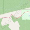
Seven Bridges Trail
United States > Colorado > El Paso County
From the upper North Cheyenne Cañon access area, the route first follows Gold Camp Road through a wooded canyon setting before joining Seven Bridges Trail, a popular path known for tracing North Cheyenne Creek. The itinerary then moves upstream beside the creek, entering denser forest and passing its…
Distance: 3.5 mi • Elevation gain: 942 ft • Maximum elevation: 8,448 ft
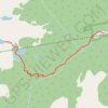
Crater Lakes via South Boulder Creek
United States > Colorado > Gilpin County > East Portal Distributed Camping Area
Starting at the Moffat Tunnel East Portal, the route enters Roosevelt National Forest and follows the South Boulder Creek Trail into the James Peak Wilderness, passing dense subalpine forest, creekside clearings, and the Forest Lakes Trail junction before turning onto the signed Crater Lakes Trail. The climb…
Distance: 6.8 mi • Elevation gain: 1,834 ft • Maximum elevation: 11,037 ft
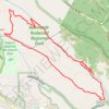
Redwood Regional Park Loop
United States > California > Alameda County
Starting at Canyon Meadow, this Redwood Regional Park loop follows the Stream Trail into the cool corridor of Redwood Creek, passing picnic clearings before entering the shaded coast-redwood forest that gives the park its character. Beyond the creekside section, the route climbs onto the French Trail,…
Distance: 6.3 mi • Elevation gain: 1,394 ft • Maximum elevation: 1,526 ft

Tom LaBonge Panorama via Bill Eckert Trail and North Trail in Griffith Park
United States > California > Los Angeles County > Los Angeles
This trail to Tom LaBonge Panorama offers a moderately challenging hike in Griffith Park, winding through scenic vistas with views of Mount Hollywood, Taco Peak, and the iconic Hollywood Sign. The trail provides a rewarding panoramic perspective of Los Angeles, including landmarks like the Griffith Park Old…
Distance: 6.2 mi • Elevation gain: 1,512 ft • Maximum elevation: 1,568 ft
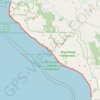
Lost Coast Trail
United States > California > Humboldt County
From Mattole Beach, the Lost Coast Trail begins on an open Pacific shoreline where sand, dunes, driftwood and low coastal vegetation lead south toward Windy Point, the Punta Gorda Light area, Cooskie Creek and Randall Creek, with the King Range rising close behind the beach and giving the route its remote,…
Distance: 26.0 mi • Elevation gain: 2,356 ft • Maximum elevation: 174 ft
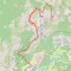
Upper Yosemite Fall, Yosemite Point, Oh My Gosh Point and Columbia Rock
United States > California > Mariposa County > Yosemite Village > Yosemite Lodge
Starting near Yosemite Lodge and the Camp Four area, this demanding route climbs the Upper Yosemite Fall Trail through oak woodland and granite switchbacks, quickly rising above Yosemite Valley toward Columbia Rock, where broad views open over the valley floor, Merced River corridor, Half Dome, and surrounding…
Distance: 9.3 mi • Elevation gain: 7,995 ft • Maximum elevation: 7,031 ft
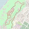
Mount Rubidoux
United States > California > Riverside County > Riverside
From the Glenwood Drive entrance, the loop follows Mount Rubidoux’s paved park road through open, boulder-strewn slopes above the Santa Ana River. It climbs past the Peace Tower and Friendship Bridge to the summit area, where the Serra Cross, flag, historic plaques, and broad Riverside views form the…
Distance: 3.0 mi • Elevation gain: 581 ft • Maximum elevation: 1,283 ft
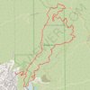
Brand Park Loop (Verdugo Mountains)
United States > California > Los Angeles County > Glendale
Starting near Brand Park, a foothill park at the base of the Verdugo Mountains, the loop leaves the landscaped edge of Glendale toward Brand Debris Basin, the Bamboo Ruins Trail, and the lower folds of Brand Canyon. The route then climbs Brand Motorway through chaparral-covered slopes and open switchbacks to…
Distance: 5.9 mi • Elevation gain: 2,592 ft • Maximum elevation: 2,828 ft
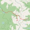
Lone Eagle Peak - Pawnee Pass
United States > Colorado > Grand County
From the Lake Granby side, this traverse begins near Monarch Lake and follows the Cascade Creek corridor into the Indian Peaks Wilderness, passing forested shoreline, Arapaho Pass Trail junction, Buchanan Creek, Cascade Creek, and waterfall-lined sections of the valley. Beyond the Cascade Creek basin, the…
Distance: 20.4 mi • Elevation gain: 6,581 ft • Maximum elevation: 12,546 ft
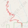
Mount Si
United States > Washington > King County
From the Mount Si Trailhead, the route enters the forested lower slopes of the Mount Si Natural Resources Conservation Area and follows the main Mount Si Trail into a steady switchbacking ascent above North Bend. After the first wooded climb, it passes through Snag Flat, an old-growth forest section, then…
Distance: 7.6 mi • Elevation gain: 3,422 ft • Maximum elevation: 4,032 ft
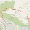
Gabrielino Trail
United States > California > Los Angeles County
Starting from Chantry Flat, the Gabrielino Trail slips from the shaded ridge above Big Santa Anita Canyon into a classic Angeles National Forest corridor of wooded slopes, creekside cabins and canyon-bottom shade. The route passes the lower canyon junctions, Cascade Picnic Area and Spruce Grove Trail Camp…
Distance: 27.6 mi • Elevation gain: 7,736 ft • Maximum elevation: 4,662 ft
Dune Climb Trail in Sleeping Bear Dunes National Lakeshore
United States > Michigan > Leelanau County
The Dune Climb Trail is a rewarding, albeit challenging, experience for visitors looking to take in stunning panoramic views of the surrounding landscape. The climb itself leads up a towering sand dune, offering vistas of Little Glen Lake from the first plateau and expansive dunes that stretch toward Lake…
Distance: 3.7 mi • Elevation gain: 656 ft • Maximum elevation: 843 ft
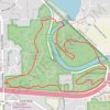
Bird Hills, Kuebler Langford, and Barton Nature Areas Loop Trail
United States > Michigan > Washtenaw County > Ann Arbor
The Bird Hills, Kuebler Langford, and Barton Nature Areas create a scenic, interconnected loop that provides hikers a range of natural features, from forested ridges to creek-cut ravines. Bird Hills offers sweeping forest trails with native flora and a historic backdrop, while Kuebler Langford complements with…
Distance: 3.9 mi • Elevation gain: 289 ft • Maximum elevation: 984 ft
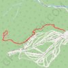
Mount Tecumseh
United States > New Hampshire > Grafton County > Waterville Valley
Starting from the Waterville Valley Ski Area parking area in White Mountain National Forest, the route follows the Mount Tecumseh Trail into mixed mountain forest, staying close to the Tecumseh Brook corridor before crossing the brook and climbing away from the ski slopes. The ascent becomes rockier and more…
Distance: 4.8 mi • Elevation gain: 2,188 ft • Maximum elevation: 3,924 ft

Ernie Maxwell Scenic Trail
United States > California > Riverside County > Idyllwild
Starting from the Idyllwild side near Tahquitz View Drive, the Ernie Maxwell Scenic Trail climbs gently through shaded pine, oak, cedar and manzanita forest on the lower slopes of the San Jacinto Mountains. The route passes granite boulders and seasonal drainages before opening occasional views across…
Distance: 2.3 mi • Elevation gain: 935 ft • Maximum elevation: 6,450 ft
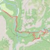
Vernal Fall and Clark Point Loop
United States > California > Mariposa County > Curry Village
The route follows the river upstream toward the waterfall approach, passing through a lively canyon setting shaped by clear pools, polished rock and constant movement from the Merced. The hike then joins the Mist Trail, where the scenery becomes more dramatic beneath Vernal Fall, with spray, stone steps, cliff…
Distance: 5.9 mi • Elevation gain: 2,644 ft • Maximum elevation: 5,574 ft

Avalanche Lake
United States > Montana > Flathead County
Starting from the Avalanche area, the route first follows the shaded Trail of the Cedars through old-growth cedar and hemlock forest beside Avalanche Creek, where the water has carved the narrow and lively passage of Avalanche Gorge. Beyond the gorge, the Avalanche Lake Trail leaves the boardwalk and climbs…
Distance: 5.9 mi • Elevation gain: 1,079 ft • Maximum elevation: 3,999 ft
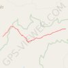
Indian Maiden Falls
United States > Arizona > Yavapai County
Beginning on the quiet uplands near Bald Hill, this route follows the upper West Clear Creek Trail across pinyon-juniper country toward the canyon rim before committing to the steep, loose descent through exposed slopes and a side drainage, with broad views into the deep gorge cut from the southern edge of the…
Distance: 4.0 mi • Elevation gain: 436 ft • Maximum elevation: 5,781 ft
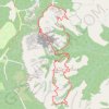
Figure-8 Combination Loop (Bryce Canyon)
United States > Utah > Garfield County
From Sunset Point, the route first follows the rim toward Sunrise Point, opening broad views over the Bryce Amphitheater before dropping into Queen’s Garden, where pale orange hoodoos, sculpted walls, and fir-dotted slopes gradually surround the trail. The descent leads from the overlook atmosphere of the…
Distance: 6.4 mi • Elevation gain: 1,640 ft • Maximum elevation: 7,976 ft
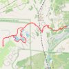
Five Lakes Loop
United States > California > Placer County > Alpine Meadows
Starting at the Five Lakes Trailhead near Alpine Meadows Road, the route follows the Five Lakes Trail away from the developed valley and climbs through open Sierra slopes, scattered conifers, and granite-studded terrain toward the edge of Tahoe National Forest. The path then enters the Granite Chief…
Distance: 6.2 mi • Elevation gain: 1,437 ft • Maximum elevation: 7,602 ft
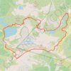
Chain Lakes and Wild Goose Trails Loop
United States > Washington > Whatcom County
From the Heather Meadows area, this loop first drops toward Bagley Dam and the open basin of Bagley Lakes, where Bagley Creek, subalpine meadows, heather, and the slopes of Table Mountain and Mount Herman shape the approach to the Chain Lakes Trail. The setting is one of the signature hiking areas of the upper…
Distance: 7.7 mi • Elevation gain: 2,044 ft • Maximum elevation: 5,466 ft
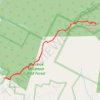
Overlook Mountain Trail
United States > New York > Ulster County > Town of Woodstock
Starting from the Overlook Mountain Trail trailhead, the route climbs steadily through Overlook Mountain Wild Forest on a broad forest track, passing mixed Catskill woodland and the slopes above Mount Guardian. Higher on the route, the path reaches the atmospheric Overlook Mountain House ruins, then continues…
Distance: 4.8 mi • Elevation gain: 1,434 ft • Maximum elevation: 3,094 ft
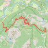
Glacier Point and Union Point via Four Mile Trail
United States > California > Mariposa County > Yosemite Village > Yosemite Lodge
From Yosemite Valley, the Four Mile Trail climbs away from the Merced River through forested slopes and long switchbacks on the south wall of the valley, steadily opening views toward Sentinel Rock, El Capitan, Yosemite Falls, and the granite cliffs that frame the valley floor. Higher on the route, the path…
Distance: 9.4 mi • Elevation gain: 5,404 ft • Maximum elevation: 7,208 ft
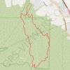
Bane Canyon Loop
United States > California > San Bernardino County > Chino Hills
Beginning near the North Entrance off Sapphire Road, the loop briefly follows Bane Canyon Road into Chino Hills State Park before leaving the paved corridor for the East Fence Line Trail, where rolling grasslands, coastal sage scrub, spring wildflowers, and views across Bane Canyon and the nearby urban edge…
Distance: 7.6 mi • Elevation gain: 1,427 ft • Maximum elevation: 1,171 ft
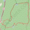
Mount Lafayette Loop
United States > New Hampshire > Grafton County > Lincoln
The Mount Lafayette Loop begins in Franconia Notch, at the edge of the White Mountain National Forest, and climbs away from the parkway into shaded hardwood and spruce forest. The route follows the Falling Waters side of the loop beside Walker Brook and Dry Brook, passing Stairs Falls and Cloudland Falls as…
Distance: 8.4 mi • Elevation gain: 3,734 ft • Maximum elevation: 5,190 ft
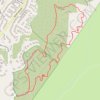
Weir Canyon Trail Loop
United States > California > Orange County > Anaheim
Starting near East Overlook Terrace and South Hidden Canyon Road in Anaheim Hills, this Weir Canyon Trail Loop enters the Weir Canyon side of Santiago Oaks Regional Park and climbs along open slopes where coastal sage scrub, grassland, and rolling foothill scenery frame the start of the hike. After the upper…
Distance: 2.7 mi • Elevation gain: 499 ft • Maximum elevation: 1,211 ft

Watchman Trail and Overlook
United States > Utah > Washington County
From the Zion Canyon Visitor Center, the Watchman Trail follows the Virgin River past the Watchman Campground area before leaving the canyon floor. The route climbs through dry desert slopes, scattered shrubs and sandstone foothills toward the Watchman overlook loop. From the viewpoint, hikers look back over…
Distance: 3.1 mi • Elevation gain: 784 ft • Maximum elevation: 4,452 ft
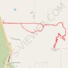
Iron Mountain
United States > California > San Diego County > Poway
From Poway Road Park and Ride, the route follows Iron Mountain Peak Trail through a short shaded start, then across open chaparral, granite outcrops, rolling foothills, and increasingly exposed slopes toward the summit of Iron Mountain. After passing the Iron Mountain Junction and the slopes around Little Iron…
Distance: 5.2 mi • Elevation gain: 1,125 ft • Maximum elevation: 2,638 ft
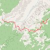
Dripping Springs (Grand Canyon)
United States > Arizona > Coconino County
Starting at historic Hermits Rest, the route leaves the South Rim gateway to the Hermit Trail and descends from the viewpoint area onto steep canyon switchbacks through the upper limestone and sandstone layers, with widening views into the Grand Canyon. The trail then passes through Waldron Basin and reaches…
Distance: 3.2 mi • Elevation gain: 1,138 ft • Maximum elevation: 6,660 ft
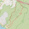
Crystal Cove State Park
United States > California > Orange County > Newport Beach
Crystal Cove State Park’s loop starts near the El Moro coastal entrance, crosses into Moro Canyon, and follows a sheltered inland corridor shaped by seasonal Moro Creek, riparian woodland, coastal sage scrub, and the rugged slopes of the San Joaquin Hills. The hike then climbs toward the higher backcountry…
Distance: 9.0 mi • Elevation gain: 1,302 ft • Maximum elevation: 1,030 ft
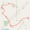
Cashmere Mountain via Little Eightmile Lake, Eightmile-Trout Creek Trail, Lake Caroline and Windy Pass
United States > Washington > Chelan County
The hike to Cashmere Mountain is a spectacular journey through the heart of the Alpine Lakes Wilderness, offering a diverse range of views. Starting at the Eightmile Lake Trailhead, the route leads you past scenic lakes like Little Eightmile Lake and Lake Caroline, each with pristine alpine waters framed by…
Distance: 9.5 mi • Elevation gain: 5,502 ft • Maximum elevation: 8,235 ft
Pacifico Mountain
United States > California > Los Angeles County
Starting at Mill Creek Summit Picnic Area, a PCT access point on Angeles Forest Highway, the hike leaves the road and follows the Pacific Crest Trail into a dry high-country landscape of chaparral, manzanita, toyon, and open slopes. After climbing above the highway, the route bends around Tie Canyon, crosses…
Distance: 6.5 mi • Elevation gain: 3,054 ft • Maximum elevation: 7,123 ft
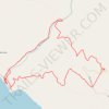
Arch Rock Loop via Glen Trail, Coast Trail and Bear Valley Trail
United States > California > Marin County
Starting from Glen Campground, this loop leaves the quiet backcountry camp area on the Glen Trail, crossing wooded ridges, small drainages, coastal scrub and open grassy slopes before bending westward toward the exposed Pacific side of Point Reyes National Seashore. The route then follows the Coast Trail…
Distance: 5.9 mi • Elevation gain: 1,138 ft • Maximum elevation: 804 ft
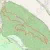
West Ridge, French and Stream Trails Loop
United States > California > Contra Costa County
From Skyline Gate, the loop first follows West Ridge Trail along the higher western edge of Reinhardt Redwood Regional Park, with evergreen woodland, chaparral openings, and views over the forested Redwood Creek basin. It then turns onto French Trail, crossing the quieter interior slopes past side-trail…
Distance: 4.5 mi • Elevation gain: 1,129 ft • Maximum elevation: 1,335 ft
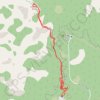
Ooh Aah Point via South Kaibab Trail
United States > Arizona > Coconino County
Starting at the South Kaibab Trailhead on the South Rim, the route leaves the rim through sparse high-desert woodland and quickly drops onto the South Kaibab Trail, following tight switchbacks below Yaki Point. The path then traverses exposed canyon slopes above the Pipe Creek drainage, with pale cliff bands,…
Distance: 2.0 mi • Elevation gain: 1,424 ft • Maximum elevation: 7,224 ft
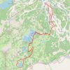
Lake Catherine Loop
United States > Utah > Salt Lake County > Brighton
Starting at Brighton Resort in Big Cottonwood Canyon, the loop leaves the ski-area base and climbs into the Brighton Lakes corridor, crossing open slopes, conifer patches, and a stream-fed drainage on the way toward Lake Mary. Beyond the dam and shoreline of Lake Mary, the route continues into a higher alpine…
Distance: 4.7 mi • Elevation gain: 1,224 ft • Maximum elevation: 9,957 ft

Ladder Canyon and Painted Canyon Loop
United States > California > Riverside County
Starting from the Painted Canyon trailhead, this loop enters the sandy wash of Big Painted Canyon, where the Mecca Hills reveal pale badland slopes, narrow walls and desert vegetation typical of the wilderness. The route then turns into Ladder Canyon, climbing through a tighter slot-like passage with rock…
Distance: 4.6 mi • Elevation gain: 1,073 ft • Maximum elevation: 1,335 ft
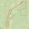
San Juan Hot Springs
United States > California > Orange County
From Ortega Flats Campground in Ronald W. Caspers Wilderness Park, the hike leaves the camping area and enters the San Juan Creek corridor, following a quiet canyon setting shaped by seasonal water, riparian vegetation, oak woodland, and chaparral-covered slopes. The route continues upstream along San Juan…
Distance: 10.2 mi • Elevation gain: 1,247 ft • Maximum elevation: 814 ft
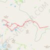
Big Pine Lakes Loop
United States > California > Inyo County
From the Glacier Lodge area, this Big Pine Lakes Loop begins along the North Fork Big Pine Creek Trail, entering the John Muir Wilderness of Inyo National Forest. The route climbs beside North Fork Big Pine Creek through forest and sagebrush slopes before reaching the higher canyon beneath Mount Alice. The…
Distance: 15.2 mi • Elevation gain: 4,052 ft • Maximum elevation: 11,260 ft
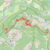
Glacier Point
United States > California > Mariposa County > Curry Village
Starting at Four Mile Trailhead in Yosemite Valley, the route joins the Four Mile Trail and begins its steady climb from the valley floor above the Merced River corridor. It first rises through forested slopes near Sentinel Creek, with early views opening toward Sentinel Rock and the meadows of Yosemite…
Distance: 4.8 mi • Elevation gain: 4,101 ft • Maximum elevation: 7,208 ft

Dripping Cave
United States > California > Orange County > Laguna Niguel
Starting from the Aliso Viejo side of Aliso and Wood Canyons Wilderness Park, the route enters the open Aliso Creek corridor and follows Aliso Creek Trail through a broad canyon floor of coastal sage scrub, riparian vegetation, and rounded hills. It then bends toward the junction with Wood Canyon Trail,…
Distance: 2.5 mi • Elevation gain: 240 ft • Maximum elevation: 246 ft
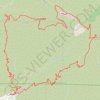
Mount Lukens Loop from Deukmejian Wilderness Park
United States > California > Los Angeles County > Glendale
Starting at Mount Lukens Trailhead in Deukmejian Wilderness Park, the route first leaves the Stone Barn area, crosses Dunsmore Creek on the lower park connector, and joins Crescenta View Trail before climbing through chaparral and sage scrub above Dunsmore Canyon toward The Redoubt. The ascent continues over…
Distance: 9.9 mi • Elevation gain: 3,494 ft • Maximum elevation: 5,043 ft
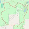
Penosha Loop Trail in Brighton State Recreation Area
United States > Michigan > Livingston County > Hamburg Township > Parishfield
The Penosha Loop Trail offers a peaceful and immersive hike through a mix of hardwood forests, scenic meadows, and ridges with glimpses of nearby lakes such as Bishop Lake. This five-mile loop is moderately challenging, with gentle slopes that provide both a good workout and moments for taking in the beauty of…
Distance: 4.9 mi • Elevation gain: 302 ft • Maximum elevation: 1,040 ft
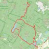
Ramapo Valley County Reservation Loop Hike: Scarlet Oak Pond, Bald Mountain, Bear Swamp Lake, MacMillan Reservoir
United States > New Jersey > Bergen County > Mahwah > Darlington
Starting from the Darlington side of Ramapo Valley County Reservation, this loop follows Vista Spur Trail toward the Ramapo River before joining Pond Loop Trail beside Scarlet Oak Pond. The route soon leaves the water on Vista Loop, climbing through the forest to Hawk Rock and Cactus Ledge, where open rock…
Distance: 12.0 mi • Elevation gain: 1,719 ft • Maximum elevation: 1,152 ft
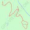
Pedernales Falls Wolf Mountain Loop
United States > Texas > Blanco County
From the Wolf Mountain trailhead, the loop enters the Hill Country woodland, crosses Regal Creek, and follows the Wolf Mountain Trail toward open views above the Pedernales River valley. The route then bends around Tobacco Mountain and Wolf Mountain, passing rocky clearings, cedar forest, and the small canyons…
Distance: 5.8 mi • Elevation gain: 410 ft • Maximum elevation: 1,073 ft
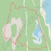
The Precipice Loop via Champlain North Ridge Trail and Schooner Head Path
United States > Maine > Hancock County > Bar Harbor
The Precipice Loop offers a thrilling yet challenging hiking experience in Acadia National Park. Hikers will enjoy sweeping views over Frenchman Bay and the surrounding coastline, with sections of the trail providing dramatic cliffside scrambles, iron rungs, and narrow ledges. As you ascend, the route unveils…
Distance: 2.8 mi • Elevation gain: 1,152 ft • Maximum elevation: 1,040 ft
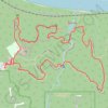
Loop hike in Fontenelle Forest via Hackberry Trail, Hawthorn Trail, Chickadee Trail, Riverview Boardwalk and Ridge Trail
United States > Nebraska > Sarpy County > Bellevue
This loop hike through Fontenelle Forest showcases a variety of scenic environments. Hikers can enjoy lush woodlands, open views of the Missouri River, and opportunities for wildlife observation, including various bird species. The well-maintained paths offer a mix of gentle slopes and boardwalks, making it…
Distance: 2.5 mi • Elevation gain: 397 ft • Maximum elevation: 1,168 ft
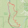
Solstice Canyon Loop
United States > California > Los Angeles County > Malibu
The Solstice Canyon Loop begins near the canyon entrance and climbs onto the sun-exposed Rising Sun Trail, where chaparral, coastal sage scrub, and open hillsides quickly replace the shaded canyon floor, revealing widening views across the folds of the Santa Monica Mountains and toward the Malibu coast. As the…
Distance: 3.0 mi • Elevation gain: 804 ft • Maximum elevation: 748 ft

Mauna Kea (Hawaii)
United States > Hawaii > Hawaiʻi County
Starting at the Maunakea Visitor Information Station, near Puʻukalepeamoa and Puʻuhauwahine, this demanding loop follows the Mauna Kea–Humuʻula Trail from the upper edge of the Mauna Kea Forest Reserve into a wide volcanic landscape of cinder, lava, and sparse alpine vegetation. As the route enters the…
Distance: 13.2 mi • Elevation gain: 4,121 ft • Maximum elevation: 13,245 ft
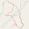
Meccacopia and Little Box Canyon Loop
United States > California > Riverside County
From the Box Canyon Road area, this loop enters the open desert of the Mecca Hills Wilderness, where sandy tracks cross low ridges, dry washes, and eroded badlands. The route follows the Meccacopia and Little Box Canyon trail corridors through a quiet landscape shaped by folded rock, pale slopes, and sparse…
Distance: 10.2 mi • Elevation gain: 1,335 ft • Maximum elevation: 1,184 ft
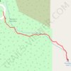
Nojoqui Falls
United States > California > Santa Barbara County
The Nojoqui Falls route begins beside the parking loop in Nojoqui Falls Park, leaving the open picnic-and-day-use area for a shaded path that quickly slips into oak- and laurel-lined woodland above Nojoqui Creek. Following the mapped trail eastward, the walk gradually narrows into a cool canyon setting,…
Distance: 0.4 mi • Elevation gain: 243 ft • Maximum elevation: 1,079 ft
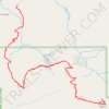
Mount Pilchuck Trail
United States > Washington > Snohomish County
Mount Pilchuck Trail begins from the forest road trailhead and climbs through evergreen woodland, crossing small drainages before entering steeper, rockier alpine terrain on the mountain’s upper slopes. The route then bends across open talus and exposed ridgeline terrain toward the Mount Pilchuck summit,…
Distance: 5.7 mi • Elevation gain: 2,218 ft • Maximum elevation: 5,246 ft
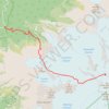
Mount Baker via Heliotrope Ridge Trail and Coleman-Deming Route
United States > Washington > Whatcom County
The Heliotrope Ridge Trail, followed by the Coleman-Deming Route, offers hikers and mountaineers a unique blend of challenging terrain and breathtaking vistas as they approach Mount Baker’s summit. As you ascend, the trail takes you past scenic alpine meadows and views of towering glaciers, particularly the…
Distance: 6.4 mi • Elevation gain: 7,106 ft • Maximum elevation: 10,719 ft
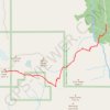
Vesper Peak via Sunrise Mine Trail in Mount Baker-Snoqualmie National Forest
United States > Washington > Snohomish County
The hike to Vesper Peak via the Sunrise Mine Trail offers a challenging and scenic adventure, where you'll experience a range of terrain types, from lush forests and expansive meadows to rocky slopes and boulder fields. As you climb, you'll be treated to panoramic views of surrounding peaks such as Morning…
Distance: 6.8 mi • Elevation gain: 4,065 ft • Maximum elevation: 6,181 ft

Fall Creek Loop Trail via Cape Horn Trail in Henry Cowell Redwoods State Park
United States > California > Santa Cruz County
The Fall Creek Loop Trail via the Cape Horn Trail offers a captivating journey through the lush redwood forests of the Santa Cruz Mountains. Along the route, hikers will encounter the peaceful flow of Fall Creek, towering second-growth redwoods, and historic lime kilns that highlight the park's rich industrial…
Distance: 3.5 mi • Elevation gain: 600 ft • Maximum elevation: 866 ft

Annette Lake Trail in Mount Baker-Snoqualmie National Forest
United States > Washington > King County
The Annette Lake Trail, nestled in the Mount Baker-Snoqualmie National Forest, offers a delightful hiking experience combining serene natural beauty and moderate physical challenge. The journey begins in lush, shaded forests dominated by towering evergreens and progresses past cascading waterfalls, talus…
Distance: 3.3 mi • Elevation gain: 1,824 ft • Maximum elevation: 3,727 ft

Lost Mine Trail in Big Bend National Park
United States > Texas > Brewster County > Chisos Mountains Basin Junction
The Lost Mine Trail in Big Bend National Park offers a breathtaking journey through the Chisos Mountains, with sweeping views of Juniper Canyon, Casa Grande, and the Sierra del Carmen in Mexico. As you ascend, the trail weaves through fragrant pine and oak forests, occasionally opening to dramatic vistas of…
Distance: 4.7 mi • Elevation gain: 1,129 ft • Maximum elevation: 6,814 ft

Camelback Mountain via Cholla Trail in Echo Canyon Recreation Area
United States > Arizona > Maricopa County > Phoenix
The Cholla Trail to the summit of Camelback Mountain offers a captivating yet demanding hiking experience, with diverse terrain ranging from gentle slopes to challenging rock scrambles as you approach the peak. The trail provides stunning views of the Phoenix cityscape and surrounding desert landscapes,…
Distance: 1.4 mi • Elevation gain: 1,181 ft • Maximum elevation: 2,598 ft

Annette Lake Trail in Mount Baker Snoqualmie National Forest
United States > Washington > King County
The Annette Lake Trail in Washington's Mount Baker-Snoqualmie National Forest offers hikers a diverse array of natural beauty. Along the well-maintained path, you'll encounter cascading waterfalls, expansive views of Granite and Humpback Mountains, and the serene Annette Lake, which is ideal for a refreshing…
Distance: 7.5 mi • Elevation gain: 2,162 ft • Maximum elevation: 3,737 ft
White Butte Highpoint Trail
United States > North Dakota > Slope County
Hiking the White Butte Highpoint Trail offers a chance to experience the raw beauty of North Dakota's rugged badlands and rolling prairies. The trail takes you past the iconic white cliffs of the butte, leading to a summit with sweeping views of the surrounding farmland, distant rock formations, and on clear…
Distance: 1.6 mi • Elevation gain: 348 ft • Maximum elevation: 3,488 ft
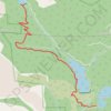
Mason Trail, Mc Reynolds Reservoir, Mason Reservoir, Boehmer Reservoir, South Slope Recreation Area, Pikes Peak, Colorado
United States > Colorado > Teller County
Distance: 9.9 mi • Elevation gain: 1,148 ft • Maximum elevation: 11,457 ft

Bike ride on the slopes of Charity Peak
United States > Montana > Missoula County > Schley
Morning Ride
Distance: 10.2 mi • Elevation gain: 1,854 ft • Maximum elevation: 5,105 ft
White Butte
United States > North Dakota > Slope County
Distance: 1.8 mi • Elevation gain: 377 ft • Maximum elevation: 3,484 ft