
Hills trails
Click on a trail to view its statistics, map and profile.
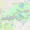
Lebanon Hills Loop via Voyageur Trek in Lebanon Hills Regional Park
United States > Minnesota > Dakota County > Eagan
The Lebanon Hills Loop is a scenic hike that immerses you in the tranquil beauty of this regional park, offering a peaceful escape from the city. The trail meanders through lush forests, past picturesque lakes, and over boardwalks that enhance the hiking experience. Along the route, you'll encounter varied…
Distance: 5.1 mi • Elevation gain: 302 ft • Maximum elevation: 984 ft
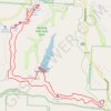
Gorge Overlook Trail and Buckeye Trail Loop Hike in Hocking Hills State Park
United States > Ohio > Hocking County > Cedar Grove
The Gorge Overlook Trail and Buckeye Trail Loop in Hocking Hills State Park provide a captivating mix of geological wonders and natural beauty. Hikers will experience stunning sandstone cliffs, cascading waterfalls like Cedar Falls and Whispering Falls, and serene spots like Rose Lake and the lush, forested…
Distance: 5.5 mi • Elevation gain: 515 ft • Maximum elevation: 945 ft
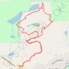
Bean and Bear Lakes Loop via Superior Hiking Trail in Superior National Forest
United States > Minnesota > Lake County > Silver Bay
The Bean and Bear Lakes Loop offers hikers a delightful experience of Minnesota’s rugged natural beauty. As you wind through thick forests, you’ll encounter breathtaking vistas of the lakes, with expansive views of the surrounding hills and the tranquil waters below. The trail, with its moderate elevation…
Distance: 6.9 mi • Elevation gain: 1,217 ft • Maximum elevation: 1,490 ft
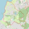
Green Loop in the Del Monte Forest trail network
United States > California > Monterey County > Del Monte Forest
From the Pebble Beach Equestrian Center, the Green Loop offers a broad circuit through Del Monte Forest, passing wooded hills and canyon-like forest areas before reaching Spanish Bay, dunes, rocky Pacific shoreline, Bird Rock Park, and the golf-course edges on the way back. #Hiking #Loop #Forest #Cost #Pacific…
Distance: 10.8 mi • Elevation gain: 1,017 ft • Maximum elevation: 686 ft
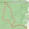
Bear Mountain Loop Trail in Mount Riga State Park
United States > Connecticut > Northwest Hills Planning Region > Salisbury
The Bear Mountain Loop Trail offers a delightful hiking experience characterized by its diverse terrain and stunning vistas. Hikers can enjoy the rugged beauty of rock scrambles leading to the summit, where the remnants of a historic stone tower provide a picturesque backdrop for breathtaking views of the…
Distance: 6.2 mi • Elevation gain: 1,572 ft • Maximum elevation: 2,300 ft
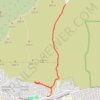
Hall Canyon
United States > California > Ventura County > San Buenaventura (Ventura)
From Hall Canyon Road, the route enters Ventura Hills Nature Preserve and follows the quiet canyon corridor between open foothill slopes. It continues along dry washes and coastal scrub typical of Ventura’s protected hillside landscape. The walk reaches the split between West Fork Hall Canyon and East Fork…
Distance: 4.7 mi • Elevation gain: 633 ft • Maximum elevation: 430 ft
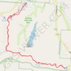
Cedar Falls from Old Man's Cave via Buckeye Trail in Hocking Hills State Park
United States > Ohio > Hocking County > Cedar Grove
The hike from Old Man's Cave to Cedar Falls offers a blend of stunning natural beauty and unique geological features. As you traverse the trail, you'll encounter the towering hemlocks, steep sandstone cliffs, and cascading waters of Cedar Falls, which is particularly impressive after rainfall. The…
Distance: 5.4 mi • Elevation gain: 463 ft • Maximum elevation: 912 ft
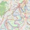
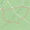
Reeves Brook Loop via Seven Hills Trail and Pine Meadow Trail in Harriman State Park
United States > New York > Rockland County > Village of Sloatsburg
The Reeves Brook Loop Trail in Harriman State Park offers hikers a diverse experience, featuring streams, small waterfalls, and rock scrambles. Along the route, one can enjoy panoramic vistas from various overlooks and traverse through vibrant woodlands, while the varied terrain—including steep ascents and…
Distance: 3.7 mi • Elevation gain: 804 ft • Maximum elevation: 1,181 ft
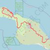
Trans Catalina Trail (TCT)
United States > California > Los Angeles County > Avalon > Pebbly Beach
The Trans-Catalina Trail begins in Avalon, leaving the island’s lively harbor town to climb into the dry, rugged interior of Santa Catalina Island. The route passes Haypress Reservoir and Cape Canyon Reservoir before entering the Black Jack backcountry and continuing toward Catalina Airport, often known as…
Distance: 38.7 mi • Elevation gain: 9,272 ft • Maximum elevation: 1,742 ft
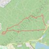
Great Blue Hill via Skyline Loop Trail in Blue Hills Reservation
United States > Massachusetts > Norfolk County > Milton
The Skyline Loop Trail in Blue Hills Reservation offers a moderately challenging hike through dense forests, leading to the summit of Great Blue Hill. Along the trail, hikers can explore the historic Eliot Observation Tower, built by the Civilian Conservation Corps during the Great Depression, which provides…
Distance: 3.1 mi • Elevation gain: 719 ft • Maximum elevation: 620 ft
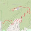
Hollywood Sign via Innsdale Trail and Mount Lee Drive in Griffith Park
United States > California > Los Angeles County > Los Angeles
The hike to the Hollywood Sign via Innsdale Trail and Mount Lee Drive offers an up-close experience with this iconic landmark, providing panoramic views of Los Angeles, the expansive Lake Hollywood Reservoir and the surrounding hills and valleys. Along the way, hikers can enjoy the natural beauty of Griffith…
Distance: 4.4 mi • Elevation gain: 978 ft • Maximum elevation: 1,631 ft
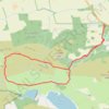
Maspie Den and Lomond Hills
United Kingdom > Scotland > Fife > Falkland
Distance: 8.8 mi • Elevation gain: 1,220 ft • Maximum elevation: 1,329 ft
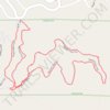
Skycrest Loop Trail in Cathedral Hills
United States > Oregon > Josephine County
Distance: 1.7 mi • Elevation gain: 243 ft • Maximum elevation: 1,424 ft
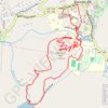
Wildcat Lake and Hemlock Hill Loop
United States > North Carolina > Avery County > Banner Elk
Starting in Banner Elk, the loop heads out through town to Mill Pond, where calm water and a pleasant valley setting introduce the walk before the route turns toward the grounds of Lees-McRae College. From there, the itinerary continues across the college area and down to Wildcat Lake, a scenic lakeside…
Distance: 4.7 mi • Elevation gain: 686 ft • Maximum elevation: 3,871 ft
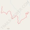
Bean D'Huez #45
United States > Arizona > Yavapai County
Downhill, bikes only trail
Distance: 0.8 mi • Elevation gain: 259 ft • Maximum elevation: 6,302 ft
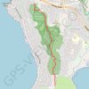
Droughty Ridgeline Trail North (Rokeby Hills)
This trail runs the ridgeline of the Rokeby Hills Bushland Reserve. Starting at the end of Mayfair Crt enter the reserve and head straight up to the top of Kuynah reserve. From here there are blue markers(arrows) to keep users on the primary ridgeline track which is also the fire trail along the reserve. The…
Distance: 2.4 mi • Elevation gain: 397 ft • Maximum elevation: 509 ft
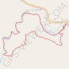
Lovers' Leap Trail in Custer State Park
United States > South Dakota > Custer County > State Game Lodge
Lovers' Leap loop trail offers a delightful mix of scenery, starting with a climb through towering ponderosa pines and leading to sweeping views of the Black Hills. The rocky outcrop at the top provides breathtaking panoramas, including views of Mount Coolidge and Black Elk Peak, making the initial uphill…
Distance: 4.3 mi • Elevation gain: 738 ft • Maximum elevation: 4,682 ft
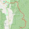
Poo-Poo Point Trail
United States > Washington > King County > Issaquah
Starting near the Issaquah High School side of West Tiger Mountain, the trail enters a shaded forest and climbs steadily through the lower slopes of the natural resources conservation area. It then follows the wooded Poo Poo Point route, passing small creek draws and mossy woodland before reaching the open…
Distance: 6.9 mi • Elevation gain: 2,142 ft • Maximum elevation: 1,847 ft
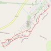
Upper Falls and Lower Falls Loop via Buckeye Trail in Hocking Hills State Park
United States > Ohio > Hocking County > Cedar Grove
Embarking on the Upper Falls to Lower Falls loop via the Buckeye Trail in Hocking Hills State Park offers hikers a journey through captivating natural features. The trail begins at the Upper Falls, leading through the Upper Gorge, past the striking Middle Falls, and culminating at the serene Lower Falls. Along…
Distance: 1.0 mi • Elevation gain: 85 ft • Maximum elevation: 915 ft
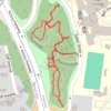
Walnut Woods of Evanstone trails
United States > Ohio > Hamilton County > Cincinnati
Distance: 0.8 mi • Elevation gain: 135 ft • Maximum elevation: 719 ft
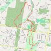
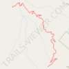
Supreme Bean #36
United States > Arizona > Yavapai County
Downhill, bikes only trail
Distance: 1.5 mi • Elevation gain: 92 ft • Maximum elevation: 6,312 ft
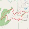
Turkey Trot Trail Loop
United States > Colorado > Jefferson County > Morrison
From the Mount Falcon Morrison Trailhead, the route sets out on Turkey Trot Trail above Vine Street, leaving the park edge for open foothill slopes, low scrub, and scattered pines with early views toward Morrison, Red Rocks Park, and the Denver plain. It continues west on Turkey Trot Trail as the loop wraps…
Distance: 3.3 mi • Elevation gain: 902 ft • Maximum elevation: 6,788 ft
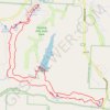
Gorge Overlook Trail and Buckeye Trail Loop via Old Man's Cave, Whispering Falls, Cedar Falls and Rose Lake
United States > Ohio > Hocking County > Cedar Grove
The Gorge Overlook Trail and Buckeye Trail Loop, starting from Old Man's Cave, offers a scenic journey through Hocking Hills State Park, showcasing its diverse geological features and lush landscapes. Hikers will encounter impressive sandstone cliffs, picturesque waterfalls such as Cedar Falls and Whispering…
Distance: 5.9 mi • Elevation gain: 548 ft • Maximum elevation: 948 ft
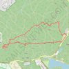
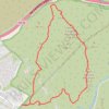
Fortuna Mountain Loop Trail in Mission Trails Regional Park
United States > California > San Diego County > San Diego
The Fortuna Mountain Loop Trail in Mission Trails Regional Park offers hikers expansive vistas of rolling hills and the vibrant San Diego cityscape. Along the route, the challenging ascent up South Fortuna's wooden steps, often dubbed the "Stairway to Heaven," provides both a physical test and rewarding…
Distance: 6.3 mi • Elevation gain: 1,371 ft • Maximum elevation: 1,266 ft
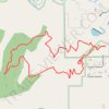
Turkey Trot Trail Loop via Castle Trail in Mount Falcon Park
United States > Colorado > Jefferson County > Morrison
From the Morrison Trailhead, the route starts on Castle Trail, leaving the edge of town for open foothill slopes, switchbacks and early views toward Red Rocks and the Denver skyline. It then joins Turkey Trot Trail, a hiker-focused section that climbs and contours through quieter pine, scrub and rocky hillside…
Distance: 3.4 mi • Elevation gain: 919 ft • Maximum elevation: 6,788 ft
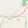
Black Elk Peak Trail in Black Hills National Forest
United States > South Dakota > Custer County > Sylvan Lake Resort
The Black Elk Peak Trail offers a fantastic hiking experience that combines natural beauty and cultural significance. Starting from Sylvan Lake, the trail winds through dense pine forests, rugged granite formations, and features the famous Cathedral Spires. The climb is moderately challenging, with rewarding…
Distance: 6.8 mi • Elevation gain: 1,503 ft • Maximum elevation: 7,169 ft
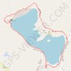
Sylvan Lake Loop Trail in Custer State Park
United States > South Dakota > Custer County > Sylvan Lake Resort
The Sylvan Lake loop is a delightful and easy hike that offers stunning scenery around the picturesque lake. This is a popular trail known for its serene views of Sylvan Lake, framed by towering granite rock formations and lush landscapes. While most of the trail is flat and accessible, the northwest section…
Distance: 1.1 mi • Elevation gain: 115 ft • Maximum elevation: 6,207 ft
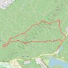
Eliot Tower and Great Blue Hill Loop via Skyline Trail in Blue Hills Reservation
United States > Massachusetts > Norfolk County > Milton
The Eliot Tower and Great Blue Hill Loop offers hikers a rewarding blend of natural beauty and historical significance. As you traverse the rocky terrain, you’ll encounter stunning panoramic views of the Boston skyline and the surrounding landscape from the summit of Great Blue Hill, making it an ideal spot…
Distance: 3.3 mi • Elevation gain: 741 ft • Maximum elevation: 614 ft
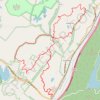
Wildcat Mountain and Indian Hill Loop
United States > New York > Orange County > Town of Tuxedo
Starting at the Tuxedo Park and Ride above the Ramapo Valley, the route climbs out of Southfields on the Wildcat Mountain Trail, passes the wooded shoulder of Wildcat Mountain, and threads a quiet ridge corridor between Harriman State Park and Sterling Forest State Park before bending toward Townsend Trail and…
Distance: 12.5 mi • Elevation gain: 2,415 ft • Maximum elevation: 1,073 ft
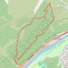
Western hills loop walk
New Zealand > Wellington > Upper Hutt City > Upper Hutt
Distance: 3.1 mi • Elevation gain: 699 ft • Maximum elevation: 676 ft
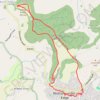
Tyndale Monument loop from Wotton-under-Edge via Westridge Wood, Nibley Knoll and Wotton Hill in the Cotswolds National Landscape
United Kingdom > England > Gloucestershire > Wotton-under-Edge
The Tyndale Monument loop offers a delightful hiking experience through the scenic landscapes of the Cotswolds, featuring a mix of woodland trails, rolling hills, and expansive views from both Nibley Knoll and Wotton Hill. Along the way, hikers can explore the historic Tyndale Monument and enjoy the natural…
Distance: 5.0 mi • Elevation gain: 623 ft • Maximum elevation: 673 ft
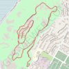
Mount Rubidoux
United States > California > Riverside County > Riverside
From the Glenwood Drive entrance, the loop follows Mount Rubidoux’s paved park road through open, boulder-strewn slopes above the Santa Ana River. It climbs past the Peace Tower and Friendship Bridge to the summit area, where the Serra Cross, flag, historic plaques, and broad Riverside views form the…
Distance: 3.0 mi • Elevation gain: 581 ft • Maximum elevation: 1,283 ft
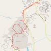
Mammoth Hot Springs Loop
United States > Wyoming > Park County > Mammoth
Starting near the Albright Visitor Center in Yellowstone National Park, this loop follows Grand Loop Road toward Palette Spring, where steaming runoff, warm mineral colors and open views introduce the Mammoth Hot Springs landscape. The route then crosses the Mammoth Terraces through Jupiter Terrace, Mound…
Distance: 2.8 mi • Elevation gain: 430 ft • Maximum elevation: 6,591 ft
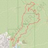
Brand Park Loop (Verdugo Mountains)
United States > California > Los Angeles County > Glendale
Starting near Brand Park, a foothill park at the base of the Verdugo Mountains, the loop leaves the landscaped edge of Glendale toward Brand Debris Basin, the Bamboo Ruins Trail, and the lower folds of Brand Canyon. The route then climbs Brand Motorway through chaparral-covered slopes and open switchbacks to…
Distance: 5.9 mi • Elevation gain: 2,592 ft • Maximum elevation: 2,828 ft
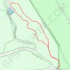
Coyote Song Trail and Swallow Trail Loop in South Valley Park
United States > Colorado > Jefferson County
The Coyote Song and Swallow Trail Loop at South Valley Park offers a peaceful escape through meadows and striking red rock formations, typical of Colorado's Front Range. Hikers will enjoy expansive views of rolling hills and nearby foothills while traversing a mostly level, well-maintained path. It's an easy…
Distance: 2.9 mi • Elevation gain: 344 ft • Maximum elevation: 6,024 ft
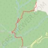
Nohkalikai Falls - Nongriat
India > Meghalaya > Shella Bholaganj
Distance: 5.0 mi • Elevation gain: 1,562 ft • Maximum elevation: 4,344 ft
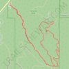
Panorama Point and Bear Creek Trail Loop in Corwina Park
United States > Colorado > Jefferson County
The Panorama Point and Bear Creek Trail Loop in Corwina Park offers a delightful escape into nature, combining forested stretches with sweeping views of the surrounding Rocky Mountains. As you hike, you'll pass through diverse terrain, including dense woodlands, rocky outcrops, and meadows, all while being…
Distance: 3.0 mi • Elevation gain: 646 ft • Maximum elevation: 7,352 ft
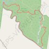
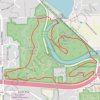
Bird Hills, Kuebler Langford, and Barton Nature Areas Loop Trail
United States > Michigan > Washtenaw County > Ann Arbor
The Bird Hills, Kuebler Langford, and Barton Nature Areas create a scenic, interconnected loop that provides hikers a range of natural features, from forested ridges to creek-cut ravines. Bird Hills offers sweeping forest trails with native flora and a historic backdrop, while Kuebler Langford complements with…
Distance: 3.9 mi • Elevation gain: 289 ft • Maximum elevation: 984 ft
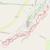
Upper Falls to Lower Falls Loop via Gorge Exit Trail and Buckeye Trail in Hocking Hills State Park
United States > Ohio > Hocking County > Cedar Grove
The Upper Falls to Lower Falls Loop in Hocking Hills State Park offers a scenic journey through stunning landscapes characterized by lush greenery, rugged sandstone cliffs, and cascading waterfalls. Along the route, hikers can enjoy the serene beauty of both the Upper and Lower Falls, each presenting a unique…
Distance: 1.2 mi • Elevation gain: 108 ft • Maximum elevation: 922 ft
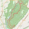
Hemlock Falls Loop via Lenape Trail, Washington Rock, Rahway Trail, and River Trail in South Mountain Reservation
United States > New Jersey > Essex County > Short Hills
The Hemlock Falls Loop offers a delightful hiking experience that combines lush woodlands and stunning views. Along the trail, hikers will encounter the picturesque Hemlock Falls, a striking 25-foot waterfall, as well as Washington Rock, which provides breathtaking vistas of the surrounding area. The trail is…
Distance: 6.0 mi • Elevation gain: 791 ft • Maximum elevation: 554 ft
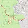
El toro church to summit and back
United States > California > Santa Clara County > Morgan Hill
From West Hills Community Church in Morgan Hill, the route leaves the neighborhood edge and joins the Open Space Authority Trail toward El Toro Open Space Preserve. It climbs through open grassland, oak woodland, and hillside switchbacks toward the prominent El Toro summit, a local landmark above the Santa…
Distance: 2.5 mi • Elevation gain: 978 ft • Maximum elevation: 1,368 ft
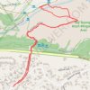
Big Tujunga Wash via Old Bert Bonnet Trail
United States > California > Los Angeles County > Los Angeles
Distance: 2.0 mi • Elevation gain: 112 ft • Maximum elevation: 1,168 ft
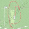
Ledges Loop Trail in Cuyahoga Valley National Park
United States > Ohio > Summit County
The Ledges Loop Trail offers a captivating hiking experience characterized by towering sandstone cliffs and lush hardwood forests. Along the trail, you'll encounter unique geological features, including intriguing rock formations with honeycomb-like patterns, as well as vibrant wildlife such as chipmunks and…
Distance: 2.4 mi • Elevation gain: 144 ft • Maximum elevation: 1,053 ft
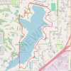
Wehrspann Lake Loop in Chalco Hills Recreation Area
United States > Nebraska > Sarpy County
The Wehrspann Lake Loop offers a pleasant and scenic hike around a large reservoir, surrounded by Nebraska's characteristic grasslands and wooded areas. The trail is paved, making it accessible and well-suited for both hikers and cyclists. Along the route, you can enjoy views of Wehrspann Lake, spot a variety…
Distance: 4.2 mi • Elevation gain: 243 ft • Maximum elevation: 1,158 ft
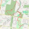
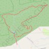
Pulpit Rock, The Pinnacle and Hamburg Reservoir Loop
United States > Pennsylvania > Berks County > Windsor Township > Edenburg
This loop trail offers a memorable hike through Pennsylvania's scenic landscape. The trail provides sweeping views from the dramatic outcrops of Pulpit Rock and The Pinnacle, where hikers can enjoy vistas of the Lehigh Valley and nearby rolling hills. Along the way, the trail winds through varied terrain, from…
Distance: 9.2 mi • Elevation gain: 1,335 ft • Maximum elevation: 1,611 ft
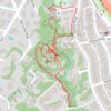
Redwood Grove Nature Preserve
United States > California > Santa Clara County > Los Altos Hills
Distance: 1.4 mi • Elevation gain: 56 ft • Maximum elevation: 236 ft
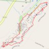
Old Man's Cave and Naturalist Cabin Loop via Gorge Exit Trail and Buckeye Trail in Hocking Hills State Park
United States > Ohio > Hocking County > Cedar Grove
The Old Man's Cave and Naturalist Cabin Loop offers a delightful hiking experience in Hocking Hills State Park, characterized by its stunning rock formations, lush greenery, and a series of picturesque waterfalls. As you traverse the trail, you'll encounter significant landmarks like Devil’s Bathtub and the…
Distance: 0.9 mi • Elevation gain: 43 ft • Maximum elevation: 915 ft
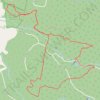
Hard Hills and Watsons Hill Diggings - Ross Creek State Forest
Distance: 6.7 mi • Elevation gain: 522 ft • Maximum elevation: 1,430 ft
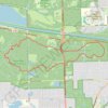
Sag Valley Yellow Loop Trail in Swallow Cliff Woods
United States > Illinois > Cook County
The Sag Valley Yellow Loop Trail offers hikers a refreshing experience through a diverse landscape, characterized by rolling hills, lush forests, and scenic vistas. As you traverse the loop, you may encounter a variety of wildlife and plant species, particularly in the spring and fall when the flora is most…
Distance: 7.8 mi • Elevation gain: 436 ft • Maximum elevation: 732 ft
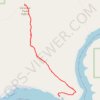
Cervidae Peak Trail in Idaho
United States > Idaho > Boise County
The Cervidae Peak Trail is a steep but rewarding hike. The path ascends through open, sagebrush-covered hills, with the effort paying off in sweeping views of the Lucky Peak and Arrowrock reservoirs, as well as the Boise foothills. While challenging due to its steep elevation gain, the summit offers a serene…
Distance: 4.7 mi • Elevation gain: 1,942 ft • Maximum elevation: 4,954 ft
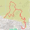
Ventura Hills Nature Preserve Trails 101 and 102 Loop
United States > California > Ventura County > Ventura
Distance: 4.9 mi • Elevation gain: 1,240 ft • Maximum elevation: 853 ft
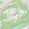
Waterfall Glen Main Trail Loop in Waterfall Glen Forest Preserve
United States > Illinois > DuPage County
The Waterfall Glen Main Trail Loop offers a picturesque hiking experience with a blend of wooded areas, rolling hills, and scenic views. Hikers can enjoy the tranquility of nature while spotting diverse wildlife and exploring unique geological features shaped by glacial activity. The trail's well-maintained…
Distance: 9.4 mi • Elevation gain: 302 ft • Maximum elevation: 768 ft
East Palisades and Bamboo Forest Loop
United States > Georgia > Fulton County > Atlanta
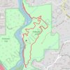
Starting from the Whitewater Creek side of the East Palisades unit, this loop follows the wooded bank of the Chattahoochee River upstream, passing rocky river edges, small islands, and open views across the water. At the northern end of the route, the path reaches the Bamboo Forest, a distinctive riverside…
Distance: 4.4 mi • Elevation gain: 666 ft • Maximum elevation: 1,017 ft
Annie's Canyon Trail via Solana Hills Trail, Rios Avenue Trail and Gemma Parks Loop
United States > California > San Diego County > Solana Beach
The hike along Solana Hills Trail, Rios Avenue Trail, and Gemma Parks Loop to Annie’s Canyon in the San Elijo Lagoon Ecological Reserve offers a serene blend of coastal wetlands, native chaparral, and sculpted sandstone canyons. As you meander through the trails, you'll encounter sweeping views of the…
Distance: 2.4 mi • Elevation gain: 427 ft • Maximum elevation: 253 ft
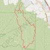
Bane Canyon Loop
United States > California > San Bernardino County > Chino Hills
Beginning near the North Entrance off Sapphire Road, the loop briefly follows Bane Canyon Road into Chino Hills State Park before leaving the paved corridor for the East Fence Line Trail, where rolling grasslands, coastal sage scrub, spring wildflowers, and views across Bane Canyon and the nearby urban edge…
Distance: 7.6 mi • Elevation gain: 1,427 ft • Maximum elevation: 1,171 ft
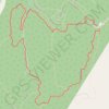
Loop hike in Hitchcock Nature Center via Badger Ridge Trail, Wildwoods, Westridge, Heritage Trail and The Chute
United States > Iowa > Pottawattamie County
This loop hike at Hitchcock Nature Center provides a scenic and dynamic journey through Iowa’s Loess Hills. Traversing the Badger Ridge, Wildwoods, and Westridge trails, hikers experience a blend of open prairie views and shaded woodlands. The route, punctuated by the steep ascent of The Chute and peaceful…
Distance: 2.9 mi • Elevation gain: 446 ft • Maximum elevation: 1,293 ft
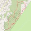
Weir Canyon Trail Loop
United States > California > Orange County > Anaheim
Starting near East Overlook Terrace and South Hidden Canyon Road in Anaheim Hills, this Weir Canyon Trail Loop enters the Weir Canyon side of Santiago Oaks Regional Park and climbs along open slopes where coastal sage scrub, grassland, and rolling foothill scenery frame the start of the hike. After the upper…
Distance: 2.7 mi • Elevation gain: 499 ft • Maximum elevation: 1,211 ft
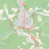
Ouray Perimeter Trail in Uncompahgre National Forest
United States > Colorado > Ouray County > Ouray
The Ouray Perimeter Trail offers hikers a scenic loop around the town of Ouray, Colorado, traversing diverse terrains including cliffs, canyons, and forested hillsides. Along the route, you'll encounter natural attractions such as Cascade Falls, the Baby Bath Tubs, and Box Canyon Falls, as well as panoramic…
Distance: 5.7 mi • Elevation gain: 1,722 ft • Maximum elevation: 8,494 ft
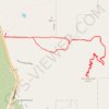
Iron Mountain
United States > California > San Diego County > Poway
From Poway Road Park and Ride, the route follows Iron Mountain Peak Trail through a short shaded start, then across open chaparral, granite outcrops, rolling foothills, and increasingly exposed slopes toward the summit of Iron Mountain. After passing the Iron Mountain Junction and the slopes around Little Iron…
Distance: 5.2 mi • Elevation gain: 1,125 ft • Maximum elevation: 2,638 ft
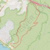
Crystal Cove State Park
United States > California > Orange County > Newport Beach
Crystal Cove State Park’s loop starts near the El Moro coastal entrance, crosses into Moro Canyon, and follows a sheltered inland corridor shaped by seasonal Moro Creek, riparian woodland, coastal sage scrub, and the rugged slopes of the San Joaquin Hills. The hike then climbs toward the higher backcountry…
Distance: 9.0 mi • Elevation gain: 1,302 ft • Maximum elevation: 1,030 ft
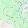
Gorge Loop Trail in Bogue Chitto State Park
United States > Louisiana > Washington Parish
The Gorge Loop Trail offers a serene hiking experience through diverse landscapes of pine-covered hills and lush lowlands. Hikers can enjoy scenic views of the Bogue Chitto River, interspersed with charming bridges and tranquil ponds, while being enveloped by the sounds of rustling leaves and chirping birds.…
Distance: 5.0 mi • Elevation gain: 262 ft • Maximum elevation: 223 ft
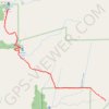
Phantom Falls Trail in North Table Mountain Ecological Preserve
United States > California > Butte County > Cherokee
The Phantom Falls Trail offers a rewarding hike through rolling hills, vibrant wildflower meadows, and unique basalt rock formations. As you journey across the open landscape, seasonal vernal pools and grazing cattle add to the rustic charm. The trail culminates at Phantom Falls, a dramatic cascade plunging…
Distance: 3.8 mi • Elevation gain: 489 ft • Maximum elevation: 1,342 ft


Little Devil's Tower Trail in Custer State Park
United States > South Dakota > Custer County > Sylvan Lake Resort
The Little Devil's Tower Trail offers an exhilarating experience that’s well worth the effort. The hike is mostly a gentle ascent through stunning rock formations, culminating in a rewarding scramble to the top where breathtaking views of the Black Hills and the Cathedral Spires await. Although the final…
Distance: 4.0 mi • Elevation gain: 988 ft • Maximum elevation: 6,900 ft

Ladder Canyon and Painted Canyon Loop
United States > California > Riverside County
Starting from the Painted Canyon trailhead, this loop enters the sandy wash of Big Painted Canyon, where the Mecca Hills reveal pale badland slopes, narrow walls and desert vegetation typical of the wilderness. The route then turns into Ladder Canyon, climbing through a tighter slot-like passage with rock…
Distance: 4.6 mi • Elevation gain: 1,073 ft • Maximum elevation: 1,335 ft
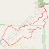
Black Elk Peak Loop via Little Devil's Tower Trail and Black Elk Peak Trail in Black Hills National Forest
United States > South Dakota > Custer County > Sylvan Lake Resort
The Black Elk Peak Loop provides an unforgettable hiking experience through the stunning Black Hills. As you ascend, you’ll enjoy diverse landscapes, including expansive forests, towering rock formations, and sweeping views from the summit of Black Elk Peak, the highest point in South Dakota, where visitors…
Distance: 7.4 mi • Elevation gain: 1,447 ft • Maximum elevation: 7,169 ft
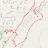
Draper Suspension Bridge Loop via Orson Smith Trail, Aqueduct Trail and Bonneville Shoreline Trail
United States > Utah > Salt Lake County > Draper
The Draper Suspension Bridge Loop offers a captivating hike through diverse landscapes. As you traverse the Orson Smith, Aqueduct, and Bonneville Shoreline Trails, you'll encounter scenic views of the Wasatch Mountains, Salt Lake Valley, and Bear Canyon, especially while crossing the impressive 185-foot…
Distance: 2.0 mi • Elevation gain: 528 ft • Maximum elevation: 5,243 ft
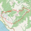
Dipsea Trail, Steep Ravine Trail and Matt Davis Trail Loop in Mount Tamalpais State Park
United States > California > Marin County > Stinson Beach
The Dipsea Trail, Steep Ravine Trail, and Matt Davis Trail Loop in Mount Tamalpais State Park offers hikers a diverse experience, beginning at Stinson Beach and ascending through coastal hills with expansive ocean vistas. The route transitions into a dense redwood forest alongside Webb Creek, featuring…
Distance: 7.4 mi • Elevation gain: 2,303 ft • Maximum elevation: 1,627 ft

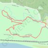
Lone Wolf Loop Trail in Castlewood State Park
United States > Missouri > Saint Louis County
The Lone Wolf Loop Trail offers a captivating mix of natural beauty and rich history. As you hike, you'll enjoy sweeping views of the Meramec River valley from the bluffs, followed by a descent through shaded forested areas with fern-covered hillsides. The trail also takes you alongside Kiefer Creek, providing…
Distance: 1.7 mi • Elevation gain: 279 ft • Maximum elevation: 620 ft

Dripping Cave
United States > California > Orange County > Laguna Niguel
Starting from the Aliso Viejo side of Aliso and Wood Canyons Wilderness Park, the route enters the open Aliso Creek corridor and follows Aliso Creek Trail through a broad canyon floor of coastal sage scrub, riparian vegetation, and rounded hills. It then bends toward the junction with Wood Canyon Trail,…
Distance: 2.5 mi • Elevation gain: 240 ft • Maximum elevation: 246 ft
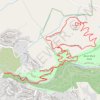
Boccardo Peak and Eagle Rock Loop
United States > California > Santa Clara County > San Jose
Starting near Upper Penitencia Creek, this loop follows the Penitencia Creek Trail through Alum Rock Park’s canyon setting before climbing onto the North Rim Trail, where the route opens toward Eagle Rock and broader views over San José and the South Bay foothills. From Eagle Rock, the hike continues onto…
Distance: 7.7 mi • Elevation gain: 1,952 ft • Maximum elevation: 1,883 ft
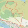
The Slacks Loop Trail in Kilpatrick Hills
United Kingdom > Scotland > West Dunbartonshire > Old Kilpatrick
Distance: 5.4 mi • Elevation gain: 1,161 ft • Maximum elevation: 1,178 ft
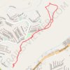
Part of Solemint Canyon Mountainway Trail
United States > California > Los Angeles County > Santa Clarita
Distance: 3.0 mi • Elevation gain: 725 ft • Maximum elevation: 2,352 ft

Bennet Heritage Trail - Bruce Trail
Canada > Ontario > Halton Region
Silver Creek Conservation Area. #Hiking #Loop #SilverCreek
Distance: 1.8 mi • Elevation gain: 197 ft • Maximum elevation: 1,083 ft

Grasslands Loop Trail and Oak Canyon Trail in Mission Trails Regional Park
United States > California > San Diego County > San Diego
The Grasslands Trail and Oak Canyon Trail Loop provides a diverse hiking experience. The Grasslands Loop offers expansive views of the rolling hills and chaparral, with opportunities for birdwatching, while the Oak Canyon Trail winds through oak groves along a dry creek bed, showcasing seasonal waterfalls. The…
Distance: 3.8 mi • Elevation gain: 420 ft • Maximum elevation: 594 ft

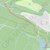
Waugh Creek Falls from Humpback Reservoir
Canada > British Columbia > Capital Regional District > Langford
Sooke Hills Wilderness Regional Park. #Hiking #MTB #WaughCreek #Humpback #SookeHills
Distance: 3.5 mi • Elevation gain: 623 ft • Maximum elevation: 541 ft
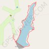
Hocking Hills Rose Lake Loop Trail
United States > Ohio > Hocking County > Logan > Cedar Grove
Distance: 1.7 mi • Elevation gain: 220 ft • Maximum elevation: 984 ft
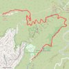
Hollywood Sign and Mount Lee
United States > California > Los Angeles County > Los Angeles
Starting from Canyon Drive in Griffith Park, the route enters Brush Canyon on the broad Brush Canyon Trail, leaving the Bronson Canyon area behind as it rises through open chaparral, dry ravine scenery, and the wooded-looking folds of the Hollywood Hills. Higher up, the trail bends across the hillside to meet…
Distance: 6.0 mi • Elevation gain: 1,447 ft • Maximum elevation: 1,634 ft

Silver Creek - Terra Cotta
Canada > Ontario > Halton Region
Bruce Trail. #Hiking #Ski #Snowshoeing
Distance: 9.2 mi • Elevation gain: 994 ft • Maximum elevation: 1,230 ft
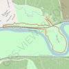
Riverscene Trail Loop in Castlewood State Park
United States > Missouri > Saint Louis County
The Riverscene Trail Loop offers a variety of scenic landscapes, ranging from rugged cliffs with expansive river valley views to tranquil riverside paths shaded by towering trees. The trail takes hikers along the edge of the Meramec River, providing several opportunities to take in panoramic vistas of the…
Distance: 3.4 mi • Elevation gain: 312 ft • Maximum elevation: 587 ft
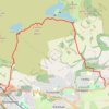
Jaw Reservoir, Cochno Hill and Greenside Reservoir in Kilpatrick Hills
United Kingdom > Scotland > West Dunbartonshire > Faifley
Distance: 5.9 mi • Elevation gain: 906 ft • Maximum elevation: 1,122 ft
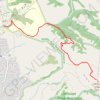
Mission Peak via Peak Trail in Mission Peak Regional Preserve
United States > California > Alameda County > Fremont
The Mission Peak via Peak Trail offers a demanding but rewarding hike that presents remarkable panoramic views throughout the ascent. As hikers climb, they are treated to vistas of the Bay Area, including San Francisco, the East Bay hills, and distant landmarks like Mount Diablo. At the summit, the iconic…
Distance: 3.3 mi • Elevation gain: 2,028 ft • Maximum elevation: 2,464 ft

Bennett Heritage Trail - Bruce Trail
Canada > Ontario > Halton Region
Silver Creek Conservation Area. #Hiking #Loop #SilverCreek
Distance: 5.5 mi • Elevation gain: 328 ft • Maximum elevation: 1,224 ft
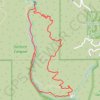
Solstice Canyon Loop
United States > California > Los Angeles County > Malibu
The Solstice Canyon Loop begins near the canyon entrance and climbs onto the sun-exposed Rising Sun Trail, where chaparral, coastal sage scrub, and open hillsides quickly replace the shaded canyon floor, revealing widening views across the folds of the Santa Monica Mountains and toward the Malibu coast. As the…
Distance: 3.0 mi • Elevation gain: 804 ft • Maximum elevation: 748 ft

Sandstone Peak Loop via Backbone Trail and Mishe Mokwa Trail Loop
United States > California > Ventura County
The Sandstone Peak Loop via Backbone Trail and Mishe Mokwa Trail offers hikers a journey through chaparral-covered hillsides, rugged sandstone formations, and shaded oak woodlands. Along the route, notable landmarks such as Split Rock and Balanced Rock provide unique geological interest, while vistas from…
Distance: 6.2 mi • Elevation gain: 1,437 ft • Maximum elevation: 3,025 ft
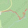
Dark Hollow Falls Trail in Shenandoah National Park
United States > Virginia > Madison County
Dark Hollow Falls Trail in Shenandoah National Park offers a scenic hike through lush forests, taking visitors through a vibrant mix of plant life, including towering hardwoods and thick underbrush. The trail leads to the breathtaking Dark Hollow Falls, where the water cascades down a series of rocky ledges,…
Distance: 1.7 mi • Elevation gain: 591 ft • Maximum elevation: 3,428 ft
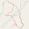
Meccacopia and Little Box Canyon Loop
United States > California > Riverside County
From the Box Canyon Road area, this loop enters the open desert of the Mecca Hills Wilderness, where sandy tracks cross low ridges, dry washes, and eroded badlands. The route follows the Meccacopia and Little Box Canyon trail corridors through a quiet landscape shaped by folded rock, pale slopes, and sparse…
Distance: 10.2 mi • Elevation gain: 1,335 ft • Maximum elevation: 1,184 ft
Rocky Run Loop via Creekside Trail in Brandywine Creek State Park
United States > Delaware > New Castle County
The Rocky Run Loop offers hikers a charming blend of scenic woodlands and peaceful creek views. The trail winds through lush hardwood forests and along the Brandywine Creek, with moments to spot stone walls crafted by early masons and sections lined with old-growth trees, adding a sense of history to the…
Distance: 3.3 mi • Elevation gain: 312 ft • Maximum elevation: 400 ft

Calico Tanks Trail in Red Rock Canyon National Conservation Area
United States > Nevada > Clark County
The Calico Tanks Trail is a fantastic way to immerse yourself in the beauty of nature while enjoying some stunning views of the Las Vegas skyline. The trail is well-marked and provides a great workout, making it easy to explore the unique sandstone formations along the way. Starting early is a smart choice, as…
Distance: 2.5 mi • Elevation gain: 469 ft • Maximum elevation: 4,751 ft

Skyline Trail, Sawcut Notch Path and Headquarters Path Loop in Blue Hills Reservation
United States > Massachusetts > Norfolk County > Quincy
This loop offers a diverse hiking experience with a blend of rocky ascents, shaded woods, and stunning vistas. Hikers can enjoy panoramic views of the Boston skyline from various points along the route, particularly from Nahanton Hill, while also passing serene spots like Saint Moritz Pond. This loop presents…
Distance: 5.4 mi • Elevation gain: 545 ft • Maximum elevation: 453 ft

Nelson Farm Trail, Willow Falls Trail and Little Falls Trail Loop in Willow River State Park
United States > Wisconsin > Saint Croix County > Town of Hudson
This loop offers a diverse hiking experience, showcasing stunning views of Little Falls Lake and the picturesque Willow Falls. As you traverse the well-maintained paths, you'll enjoy a blend of forest scenery, river landscapes, and opportunities to observe local wildlife and vibrant wildflowers, particularly…
Distance: 5.7 mi • Elevation gain: 410 ft • Maximum elevation: 925 ft